

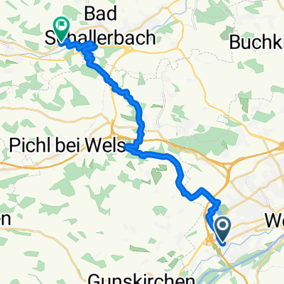
Wels nach Leonding
A cycling route starting in Thalheim bei Wels, Upper Austria, Austria.
Overview
About this route
- -:--
- Duration
- 31.7 km
- Distance
- 71 m
- Ascent
- 113 m
- Descent
- ---
- Avg. speed
- 320 m
- Max. altitude

Route quality
Waytypes & surfaces along the route
Waytypes
Access road
12 km
(38 %)
Quiet road
9.8 km
(31 %)
Surfaces
Paved
22.8 km
(72 %)
Unpaved
3.2 km
(10 %)
Asphalt
22.8 km
(72 %)
Unpaved (undefined)
1.6 km
(5 %)
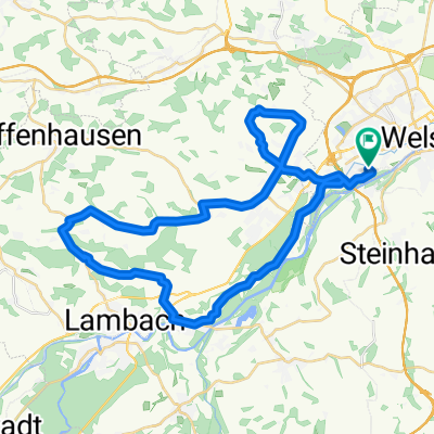
Route highlights
Points of interest along the route
Point of interest after 19.1 km
weingarten donnerszag 16 bis 18 Uhr
Point of interest after 30.3 km
Mayr am Imberg
Point of interest after 31.2 km
die Buschenschank
Point of interest after 31.7 km
N;ussböckgut Freitag und Samstag: 14:00 Uhr bis 22:00 Uhr (auch an Feiertagen)
Continue with Bikemap
Use, edit, or download this cycling route
You would like to ride Wels nach Leonding or customize it for your own trip? Here is what you can do with this Bikemap route:
Free features
- Save this route as favorite or in collections
- Copy & plan your own version of this route
- Sync your route with Garmin or Wahoo
Premium features
Free trial for 3 days, or one-time payment. More about Bikemap Premium.
- Navigate this route on iOS & Android
- Export a GPX / KML file of this route
- Create your custom printout (try it for free)
- Download this route for offline navigation
Discover more Premium features.
Get Bikemap PremiumFrom our community
Other popular routes starting in Thalheim bei Wels
 Lindenstraße 24, Wels nach Steinbergstraße 5, Marchtrenk
- Distance
- 12.6 km
- Ascent
- 3 m
- Descent
- 67 m
- Location
- Thalheim bei Wels, Upper Austria, Austria
 Von Wels bis Schlüßlberg
- Distance
- 17.6 km
- Ascent
- 357 m
- Descent
- 345 m
- Location
- Thalheim bei Wels, Upper Austria, Austria
 Wels nach Linz Magdalena2
- Distance
- 40.3 km
- Ascent
- 95 m
- Descent
- 145 m
- Location
- Thalheim bei Wels, Upper Austria, Austria
 Steinhaus-Hubi-Eberstalzell-Steinerkirchen-Gartner
- Distance
- 51.5 km
- Ascent
- 420 m
- Descent
- 421 m
- Location
- Thalheim bei Wels, Upper Austria, Austria
 Wels - Riethal - Pennewang - Wels
- Distance
- 41.4 km
- Ascent
- 182 m
- Descent
- 184 m
- Location
- Thalheim bei Wels, Upper Austria, Austria
 Wels - Riethal - Pennewang - Wels
- Distance
- 41.3 km
- Ascent
- 182 m
- Descent
- 184 m
- Location
- Thalheim bei Wels, Upper Austria, Austria
 Wels-Lambach-Wels
- Distance
- 41.1 km
- Ascent
- 493 m
- Descent
- 494 m
- Location
- Thalheim bei Wels, Upper Austria, Austria
 WÖS CALLING
- Distance
- 239.3 km
- Ascent
- 124 m
- Descent
- 254 m
- Location
- Thalheim bei Wels, Upper Austria, Austria
Open it in the app