Premium Badge Download on the App Store Get it on Google Play Turn-by-turn Navigation Offline Maps Bike Type Optimized Routing Premium Maps Custom Bike Computer Export Routes Route Previews Fall Detection Premium Support

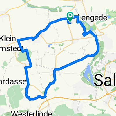
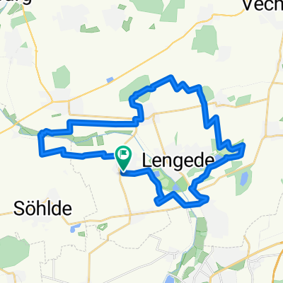
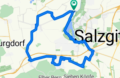
Cycling Route in Lengede, Lower Saxony, Germany

Geocaching 1

0
Open this route in the Bikemap app

Open this route in the Bikemap app

Open this route in Bikemap Web

Open this route in Bikemap Web

27 km
Distance
109 m
Ascent
109 m
Descent
-:-- h
Duration
-- km/h
Avg. Speed
--- m
Max. Elevation

About This Route

Kleine geocachign runde

This cycling route is ideal for: Road bike MTB City bike

You will cycle on the following surfaces: Paved Unpaved Gravel

Highlights Along The Route

Point of Interest

Turm N 52° 08.887 E 010° 18.825 Cachort ist jetzt mit einem grünen GC gekennzeichnet

Point of Interest

Schlosskirche Salder N 52° 08.288 E 010° 20.180 Baum, unten

Point of Interest

N 52° 07.681 E 010° 19.082

More highlights are available with Bikemap for iOS and Android.

Customize this cycling route with the Bikemap route planner.

Make it yours!

Did you know? You can use this route as a template in our cycling route planner if you don't wish to start from scratch. Customize it based on your needs to plan your perfect cycling tour.

Open it in the app