Premium Badge Download on the App Store Get it on Google Play Turn-by-turn Navigation Offline Maps Bike Type Optimized Routing Premium Maps Custom Bike Computer Export Routes Route Previews Fall Detection Premium Support

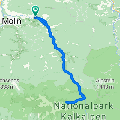
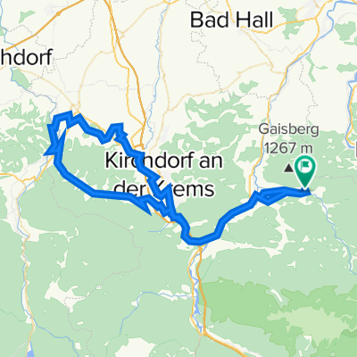
Cycling Route in Ternberg, Upper Austria, Austria

Hohe Dirn (1134m) von Trattenbach

1
Open this route in the Bikemap app

Open this route in the Bikemap app

Open this route in Bikemap Web

Open this route in Bikemap Web

29 km
Distance
1204 m
Ascent
1204 m
Descent
4:19 h
Duration
-- km/h
Avg. Speed
--- m
Max. Elevation

About This Route

Mit dem Mountainbike läßt sich - kurze Gehzeit inklusive - recht bequem der schöne Gipfel der Hohen Dirn erreichen. Möglich wird das weil in der Region zwischen dem Enns- und dem Steyrtal inzwischen viele Forstwege fürs Mountainbike freigegeben sind. Die meisten lassen den Gipfel aber im wahrsten Sinne des Wortes links liegen und fahren gleich zur Anton Schosser Hütte weiter.
Customize this cycling route with the Bikemap route planner.

Make it yours!

Did you know? You can use this route as a template in our cycling route planner if you don't wish to start from scratch. Customize it based on your needs to plan your perfect cycling tour.

Open it in the app