


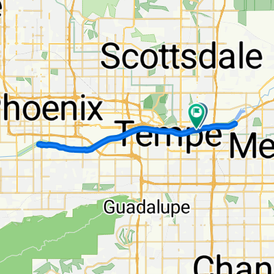
E Garfield St, Scottsdale to S Rural Rd, Tempe
Una ruta en bici que comienza en Tempe, Arizona, Estados Unidos.
Visión General
Sobre esta ruta
0
You start at the intersection of Garfield and Ashford Streets in Scottsdale. This is a quiet street with a gentle incline. After a short time, you will reach the intersection of Ashford and Willow Road. This is a paved road, and you will continue for a short distance. After this, you will reach the intersection of Willow and Apache Road. This is a paved road, and you will continue for a short distance. After this, you will reach the intersection of Apache and Cactus Road. This is a paved road, and you will continue for a short distance. After this, you will reach the intersection of Cactus and Honey Road. This is a paved road, and you will continue for a short distance. After this, you will reach the intersection of Honey and Willow Road. This is a paved road, and you will continue for a short distance. After this, you will reach the intersection of Willow and Ashford Road. This is a paved road, and you will continue for a short distance. After this, you will reach the intersection of Ashford and Garfield Street. This is a paved road, and you will continue for a short distance. After this, you will reach the intersection of Garfield and Ashford Streets in Scottsdale.
Generado por IA
- 39 min
- Duración
- 11,1 km
- Distancia
- 62 m
- Ascenso
- 75 m
- Descenso
- 16,9 km/h
- Velocidad Media
- 371 m
- Altitud máxima
W Wilson
creado hace 2 meses
Calidad de la ruta
Tipos de vía y superficies a lo largo de la ruta
Tipos de vía
Carril bici
8,2 km
74 %
Carretera tranquila
1,4 km
13 %
Superficies
Pavimentado
10,5 km
(95 %)
Sin pavimentar
0,1 km
(1 %)
Hormigón
8,1 km
73 %
Asfalto
2,2 km
20 %
Continuar con Bikemap
Usa, edita o descarga esta ruta en bici
¿Te gustaría recorrer E Garfield St, Scottsdale to S Rural Rd, Tempe o personalizarla para tu propio viaje? Esto es lo que puedes hacer con esta ruta de Bikemap:
Funciones gratuitas
- Guarda esta ruta como favorita o en una colección
- Copia y planifica tu propia versión de esta ruta
- Sincroniza tu ruta con Garmin o Wahoo
Funciones Premium
Prueba gratuita de 3 días o pago único. Más información sobre Bikemap Premium.
- Navega esta ruta en iOS y Android
- Exporta un archivo GPX / KML de esta ruta
- Crea tu impresión personalizada (pruébala gratis)
- Descarga esta ruta para la navegación sin conexión
Descubre más funciones Premium.
Consigue Bikemap PremiumDe nuestra comunidad
Tempe: Otras rutas populares que empiezan aquí


 614–626 S McClintock Dr, Tempe to 1006 S McClintock Dr, Tempe1
- 59 km
- 201 m
- 197 m
- Tempe, Arizona, Estados Unidos

 1715 E Don Carlos Ave, Tempe to 1925 E Hayden Ln, Tempe2
- 22,1 km
- 75 m
- 77 m
- Tempe, Arizona, Estados Unidos


Ábrela en la app