


Villa Valacchio, Colle di Val d'Elsa nach Via Romana, Poggibonsi
- 5,3 km
- 84 m
- 112 m
- Colle di Val d'Elsa, Región de Toscana, Italia
Una ruta en bici que comienza en Colle di Val d'Elsa, Región de Toscana, Italia.
Resumen
Ruta muy pintoresca que se dirige a la región de Chianti. Oportunidad para ver viñedos y hermosos paisajes.
Anna Nevergiveup, (anonymous) y Arlette Hartstra han añadido esta ruta a marcadores.
creado hace 9 años
Calidad de la ruta
Carretera
16,4 km
18 %
Carretera tranquila
1,8 km
2 %
Pavimentado
79,9 km
(88 %)
Sin asfaltar
1,8 km
(2 %)
Asfalto
79,9 km
88 %
Sin asfaltar (sin definir)
0,9 km
1 %
Destacados de la ruta
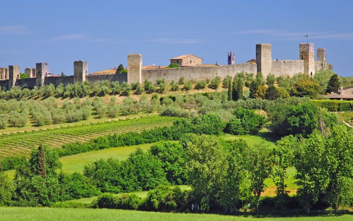
Monteriggioni is a medieval walled town, located on a natural hillock, built by the Sienese in 1214–19 as a front line in their wars against Florence,by assuming command of the Via Cassia running through the Val d'Elsa and Val Staggia to the west. During the conflicts between Siena and Florence in the Middle Ages, the city was strategically placed as a defensive fortification. It also withstood many attacks from both the Florentines and the forces of the Bishop of Volterra. In 1554 the Sienese were able to place control of the town's garrison to Giovannino Zeti, who had been exiled from Florence. In 1554, in an act of reconciliation with the Medicis, Zeti simply handed the keys of the town over to the Medicean forces - considered a "great betrayal" by the town's people.
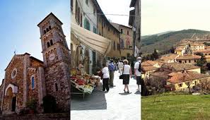
Castellina came to prominence in the mediaeval period as witnessed not just by the structures in Castellina itself but also the many magnificent fortified farm houses and tower houses dotted through the territory. The Cassero di Grignano, for example, overlooks a bridge that crosses the Cerchiaio gully and the Pesa stream, thereby controlling commercial traffic between Castellina and Panzano, and thus also between Sienna and Florence. Pietrafitta and Grignano are mentioned in a donation made by Marchese Ugo to the Marturi Abbey in 998.
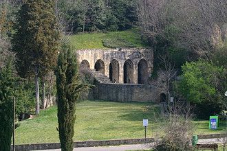
The only architectural evidence on the looming hillock known as Poggio Bonizio, the Fonte delle Fate or Fonte di Vallepiatta is for dimensions the largest public fountain in travertine of the entire territory of Siena, as well as an extraordinary example of medieval hydraulic archaeology. Erected around the first years of the 13th century, probably by the unknown "Magister lapidum" Balugano da Crema, it was interred in 1484 to make room for the construction site of the Medici Fortress ordered by Lorenzo the Magnificent. Following excavation work, in 1803 it was brought to light and later restored. It is formed by a portico with six double round arches supported by pilasters. A canalization system collects the waters from the hill and conveys it to basins situated inside. Sited in an archaeological-environmental park, the fountain today is on the itineraries of villages and castles of the area.
Continuar con Bikemap
¿Te gustaría recorrer Gippo Bike - Castellina in Chianti - Poggibonsi - San Gimignano (Siena) o personalizarla para tu propio viaje? Esto es lo que puedes hacer con esta ruta de Bikemap:
Prueba gratuita de 3 días o pago único. Más información sobre Bikemap Premium.
Descubre más funciones Premium.
Consigue Bikemap PremiumDe nuestra comunidad


Ábrela en la app