Berg à vélo
Découvre une carte de 66 itinéraires et pistes cyclables près de Berg, créés par notre communauté.
Portrait de région
Fais connaissance avec Berg
Trouve l’itinéraire à vélo qui te convient à Berg, où nous avons 66 pistes cyclables à explorer. La plupart des gens enfourchent leur vélo pour rouler ici au mois de juin.
3 217 km
Distance enregistrée
66
Itinéraires cyclables
1 229
Population
Communauté
Utilisateurs les plus actifs à Berg
De notre communauté
Les meilleurs itinéraires à vélo dans et autour de Berg
Berg-Ljungsjön-Odensnäs
Itinéraire à vélo à Berg, Comté d'Östergötland, Suède
- 33 km
- Distance
- 177 m
- Montée
- 177 m
- Descente
Berg - Navekvarn
Itinéraire à vélo à Berg, Comté d'Östergötland, Suède
- 109 km
- Distance
- 354 m
- Montée
- 379 m
- Descente
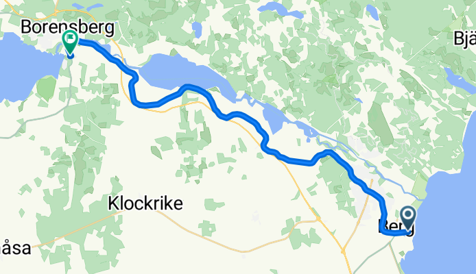
Spantvägen, Vreta Kloster nach Strandbadens campingområde, Borensberg
Itinéraire à vélo à Berg, Comté d'Östergötland, Suède
- 22,3 km
- Distance
- 54 m
- Montée
- 17 m
- Descente
Berg Schleusentreppe--RW Götakanal--Borensberg--RW Motalaström/Götakanal--Brunneby Herrgard/ Kyrka--Ljungs Slott--Vreta Kloster/Garden--Berg Schleusentreppe
Itinéraire à vélo à Berg, Comté d'Östergötland, Suède
- 49,6 km
- Distance
- 227 m
- Montée
- 223 m
- Descente
Découvrez plus d'itinéraires
 Roxen R
- Distance
- 85,5 km
- Montée
- 473 m
- Descente
- 471 m
- Emplacement
- Berg, Comté d'Östergötland, Suède
 Berg--RW Götakanal--Borensberg--Motala Schleuse--Väster (Biskopvagen Aussichtspunkt)--Motala Bahnhof
- Distance
- 51 km
- Montée
- 230 m
- Descente
- 188 m
- Emplacement
- Berg, Comté d'Östergötland, Suède
 Berg - Rappestad - Maspelösa - Ljung
- Distance
- 47,6 km
- Montée
- 189 m
- Descente
- 189 m
- Emplacement
- Berg, Comté d'Östergötland, Suède
 Sectra
- Distance
- 14,8 km
- Montée
- 78 m
- Descente
- 57 m
- Emplacement
- Berg, Comté d'Östergötland, Suède
 29k platt - Odensnäs - Maspelösa
- Distance
- 29,2 km
- Montée
- 153 m
- Descente
- 155 m
- Emplacement
- Berg, Comté d'Östergötland, Suède
 18k norrut
- Distance
- 17,9 km
- Montée
- 239 m
- Descente
- 241 m
- Emplacement
- Berg, Comté d'Östergötland, Suède
 Tjällmo ToR
- Distance
- 73,8 km
- Montée
- 245 m
- Descente
- 239 m
- Emplacement
- Berg, Comté d'Östergötland, Suède
 Vånga ToR
- Distance
- 49,8 km
- Montée
- 391 m
- Descente
- 398 m
- Emplacement
- Berg, Comté d'Östergötland, Suède


