
Wangelnstedt à vélo
Découvre une carte de 16 itinéraires et pistes cyclables près de Wangelnstedt, créés par notre communauté.
Portrait de région
Fais connaissance avec Wangelnstedt
Trouve l’itinéraire à vélo qui te convient à Wangelnstedt, où nous avons 16 pistes cyclables à explorer.
613 km
Distance enregistrée
16
Itinéraires cyclables
681
Population
Communauté
Utilisateurs les plus actifs à Wangelnstedt


De notre communauté
Les meilleurs itinéraires à vélo dans et autour de Wangelnstedt
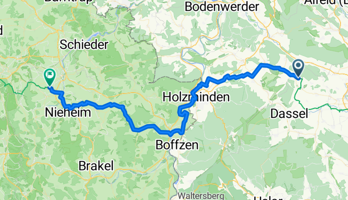
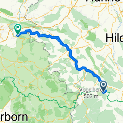
Wangelnstedt - Steinheim
Itinéraire à vélo à Wangelnstedt, Lower Saxony, Germany
- 70,7 km
- Distance
- 335 m
- Montée
- 409 m
- Descente
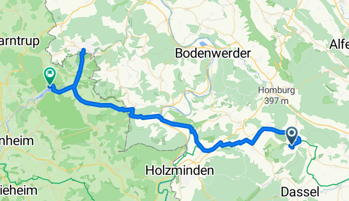
От Hühnerberg 8, Dassel до L580 19, Dassel
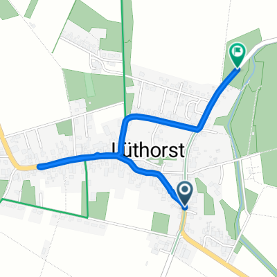
Itinéraire à vélo à Wangelnstedt, Lower Saxony, Germany
- 6,3 km
- Distance
- 0 m
- Montée
- 67 m
- Descente
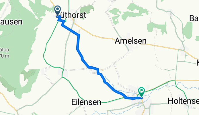
Snail-like route in Einbeck
Itinéraire à vélo à Wangelnstedt, Lower Saxony, Germany
- 10,9 km
- Distance
- 56 m
- Montée
- 116 m
- Descente
Découvrez plus d'itinéraires
 Mühlenbergstraße 16, Wangelnstedt nach Borlefzen, Vlotho
- Distance
- 88,9 km
- Montée
- 242 m
- Descente
- 468 m
- Emplacement
- Wangelnstedt, Lower Saxony, Germany
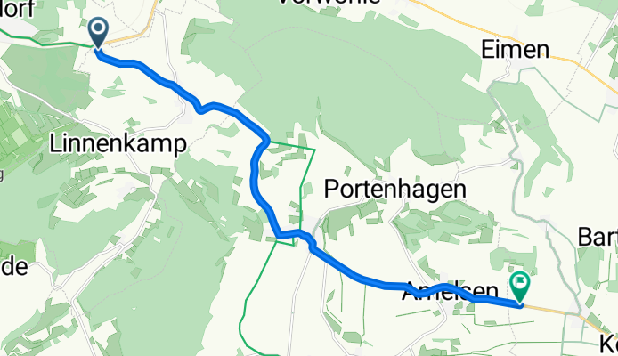
 Mühlenbergstraße 16, Wangelnstedt nach Homburgstraße 8, Eschershausen
- Distance
- 10 km
- Montée
- 20 m
- Descente
- 144 m
- Emplacement
- Wangelnstedt, Lower Saxony, Germany
 Elfasblick 3, Wangelnstedt nach Sollingtor 9, Dassel
- Distance
- 14,8 km
- Montée
- 214 m
- Descente
- 187 m
- Emplacement
- Wangelnstedt, Lower Saxony, Germany
 L546, Wangelnstedt nach Schulwiese 6, Wangelnstedt
- Distance
- 47,6 km
- Montée
- 398 m
- Descente
- 402 m
- Emplacement
- Wangelnstedt, Lower Saxony, Germany
 Luthardstraße 14, Dassel nach K526, Dassel
- Distance
- 1,7 km
- Montée
- 17 m
- Descente
- 14 m
- Emplacement
- Wangelnstedt, Lower Saxony, Germany
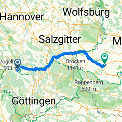 Bonn- Berlin 4. Etappe Emmerlborn - Halberstadt
- Distance
- 132,5 km
- Montée
- 536 m
- Descente
- 747 m
- Emplacement
- Wangelnstedt, Lower Saxony, Germany
 Ostertour B
- Distance
- 58,6 km
- Montée
- 416 m
- Descente
- 395 m
- Emplacement
- Wangelnstedt, Lower Saxony, Germany
 Recovered Route
- Distance
- 45,8 km
- Montée
- 559 m
- Descente
- 559 m
- Emplacement
- Wangelnstedt, Lower Saxony, Germany