À quoi pourrait ressembler le cyclisme à Diedorf.

Diedorf à vélo

Découvre une carte de 332 itinéraires et pistes cyclables près de Diedorf, créés par notre communauté.

Portrait de région

Fais connaissance avec Diedorf

Trouve l’itinéraire à vélo qui te convient à Diedorf, où nous avons 332 pistes cyclables à explorer. La plupart des gens enfourchent leur vélo pour rouler ici aux mois de mai et juillet.

19 497 km

Distance enregistrée

332

Itinéraires cyclables

10 006

Population

Communauté

Utilisateurs les plus actifs à Diedorf

De notre communauté

Les meilleurs itinéraires à vélo dans et autour de Diedorf

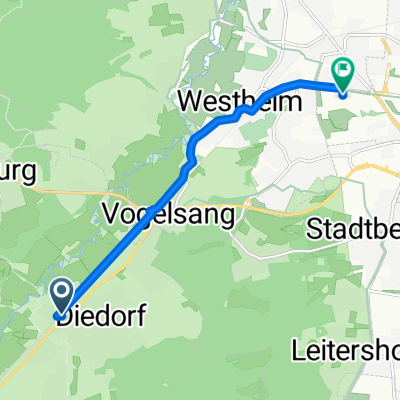
Staudenrundtour nach Bobingen und zurück
Vélo de routeRevêtu
diedorfbiker
4

Staudenrundtour nach Bobingen und zurück

Itinéraire à vélo à Diedorf, Bavaria, Germany

Diedorf-Gesserts-Oberschönefeld-Waldberg-Bobingen-Bergheim-Deuringen-Diedorf
44,1 km
Distance
306 m
Montée
304 m
Descente
Waldidyllen
Vélo de villeRevêtuNon revêtu
2

Waldidyllen

Itinéraire à vélo à Diedorf, Bavaria, Germany

Früher verbrachten die Fugger und ihre hohen Gäste hier ihre Sommerfrische. Heute sind die „Stauden“ im Süden des Naturparks Augsburg-Westliche Wälder eine der beliebtesten Ausflugsgegenden zum Radeln. Ursprüngliche, stille Mußedörfer liegen eingebettet in den schmalen Wiesentälern einer ansonsten weiten Waldlandschaft. Dorfkultur und Volksfrömmigkeit gelten dort wie eh und je. (Tourbeschreibung unter: thod_er@gmx.de)
53,4 km
Distance
873 m
Montée
869 m
Descente
Westliche Wälder
Non revêtuGravier
2

Westliche Wälder

Itinéraire à vélo à Diedorf, Bavaria, Germany

23,2 km
Distance
291 m
Montée
282 m
Descente
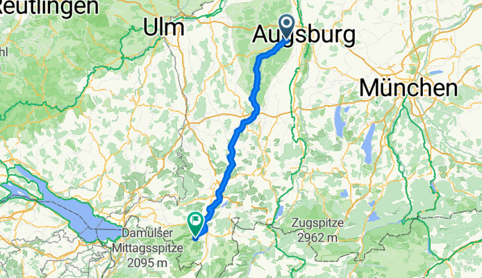
Diedorf - Angerhütte
Vélo de routeRevêtu
diedorfbiker
0

Diedorf - Angerhütte

Itinéraire à vélo à Diedorf, Bavaria, Germany

<span style="font-size: 8pt;">Diedorf</span> <span style="font-size: 8pt;">Gessertshausen<span>    </span>121</span> <span style="font-size: 8pt;"> </span> <span style="font-size: 8pt;">Margertshausen</span> <span style="font-size: 8pt;">Fischach</span> <span style="font-size: 8pt;">Wollmetshofen</span> <span style="font-size: 8pt;">Langenneufnach</span> <span style="font-size: 8pt;">Walkertshofen</span> <span style="font-size: 8pt;">Reichertshofen</span> <span style="font-size: 8pt;">Mittelneufnach</span> <span style="font-size: 8pt;">Oberneufnach</span> <span style="font-size: 8pt;">Marktwald</span> <span style="font-size: 8pt;"> </span> <span style="font-size: 8pt;">Tussenhausen<span>       </span>88</span> <span style="font-size: 8pt;"> </span> <span style="font-size: 8pt;">Mattsies</span> <span style="font-size: 8pt;"> </span> <span style="font-size: 8pt;">Mindelheim<span>          </span>79</span> <span style="font-size: 8pt;"> </span> <span style="font-size: 8pt;">Apfeltrach</span> <span style="font-size: 8pt;">Dirlewang</span> <span style="font-size: 8pt;">Unteregg</span> <span style="font-size: 8pt;">Oberegg</span> <span style="font-size: 8pt;">Rappen</span> <span style="font-size: 8pt;">Sonderhof</span> <span style="font-size: 8pt;">Neeuried</span> <span style="font-size: 8pt;">Hahnenbühl</span> <span style="font-size: 8pt;">Wolfs</span> <span style="font-size: 8pt;"> </span> <span style="font-size: 8pt;">Obergünzburg<span>      </span>52</span><span style="font-size: 8pt;"></span> <span style="font-size: 8pt;"> </span> <span style="font-size: 8pt;">Immenthal</span> <span style="font-size: 8pt;">Sellthüren</span> <span style="font-size: 8pt;">Eufnach</span> <span style="font-size: 8pt;">Ellenberg</span> <span style="font-size: 8pt;">Wildpoldsried</span> <span style="font-size: 8pt;">Bogenried</span> <span style="font-size: 8pt;"> </span> <span style="font-size: 8pt;">Betzigau<span>                               </span>37</span> <span style="font-size: 8pt;"> </span> <span style="font-size: 8pt;">Mühlstatt</span> <span style="font-size: 8pt;">Haßberg</span> <span style="font-size: 8pt;">Fahls</span> <span style="font-size: 8pt;"> </span> <span style="font-size: 8pt;">Durach<span>                   </span>32</span> <span style="font-size: 8pt;"> </span> <span style="font-size: 8pt;">Seebach</span> <span style="font-size: 8pt;">Sulzberg</span> <span style="font-size: 8pt;">Kenels</span> <span style="font-size: 8pt;">Ottacker</span> <span style="font-size: 8pt;">Rottach</span> <span style="font-size: 8pt;">Humbach</span> <span style="font-size: 8pt;">Greggenhofen</span> <span style="font-size: 8pt;">Rauhenzell</span> <span style="font-size: 8pt;">Altmummen</span> <span style="font-size: 8pt;">Tanne</span> <span style="font-size: 8pt;">Ettensberg</span> <span style="font-size: 8pt;"> </span> <span style="font-size: 8pt;">Gunzesried<span>           </span>4</span> <span style="font-size: 8pt;">Angerhütte</span>  
133,4 km
Distance
1 026 m
Montée
765 m
Descente

Découvrez plus d'itinéraires