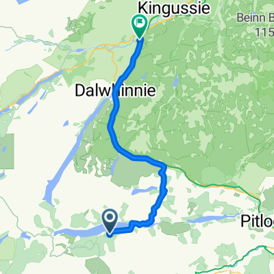
Kingussie - Aviemore
- 50,3 km
- 360 m
- 599 m
- Kingussie, Ecosse, Royaume-Uni
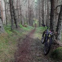
This route includes a nice singletrack climb and two singletrack descents. Start at the memorial Gardens in Kingussie. Take the road towards Insh passing Ruthven Barracks. At Tromie Bridge turn right on a dirt road (1). After 200 yds. turn sharp left (2) uphill to Drumguish. Turn right at the junction and follow this road/track through two gates into the forest. Stay on this forest road as it climbs uphill. When the gradient flattens out look out for a track crossing the road (3). Turn left on this twintrack which soon becomes singletrack. Muddy in a couple of places. Look out for a sharp turn on the right (4) and follow this uphill. This singletrack climb is rideable all the way. It eventually ends at a forest track (5). Turn right here and arrive quite soon at the summit of Creag Dhubh (6). From the summit follow the singletrack taking the right fork. At the fence corner take the left hand track and follow this downhill. Just after you enter the trees the track splits. Turn right going steeply downhill. This section is known locally as The Green Dream. At the end of this track turn left on the forest road (7). Follow this and take the next turning on the left on another forest road (8). Carry on to the end of this road and turn left (9). A little further on where the road splits take the left road (10). This track climbs back up to Creag Dhubh. A few hundred yards before the summit on the right you will see the end of the singletrack climb that you came up earlier. Turn onto this and follow it back down . At the bottom turn right and continue on. Look out for a very narrow track through heather on your left (11). Take this and follow it downhill to the forest road.(12). Turn left and continue to the forest crossroads. Turn right here and follow your outward route back to Drumguish and Kingussie.
Route forestière
11 km45 %Sentier
5,6 km23 %Pavé
0,7 km(3 %)Non pavé
15,6 km(64 %)Gravier
10 km41 %Sol
5,6 km23 %Essai gratuit de 3 jours, ou paiement unique. En savoir plus sur Bikemap Premium.
Découvre plus de fonctionnalités Premium.
Obtiens Bikemap PremiumOuvre-la dans l’app