Kingussie, Newtonmore Wild Cat trail and Loch Gynack
Un itinéraire vélo au départ de Kingussie, Ecosse, Royaume-Uni.
Vue d'ensemble
À propos du circuit
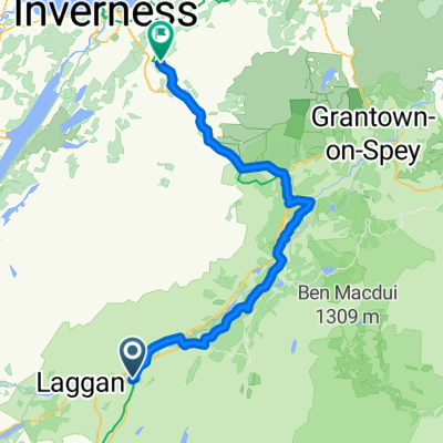
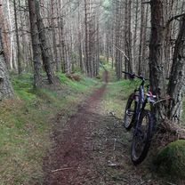
Il s'agit d'un itinéraire de longueur moyenne de 16 km / 10 miles adapté aux VTT. Certaines sections sont sur du bitume et des chemins de domaine mais d'autres se trouvent sur des chemins accidentés et pour une section, il faudra soulever le vélo par-dessus plusieurs clôtures. Prévoyez 2 heures. Carte de l'Ordnance Survey 35 Kingussie et montagnes Monadliath. Restauration : cafés et bars à Kingussie et Newtonmore. Commencez dans le centre de Kingussie et prenez la piste cyclable dédiée vers Newtonmore. Tournez à droite dans Glen Road au centre-ville de Newtonmore et suivez cette route tranquille jusqu'à ce que vous arriviez à un panneau pour le Wildcat Trail sur votre droite. Suivez les balisages du Wildcat Trail à travers un bois léger et des champs de moutons où le terrain est accidenté par endroits. Le vélo devra être soulevé par-dessus plusieurs passages et clôtures sur cet tronçon (il peut être plus facile de dévier et de traverser le champ adjacent). Lorsque le sentier sort sur la campagne ouverte, prenez un chemin de domaine quelques mètres à droite puis presque immédiatement tournez à gauche et en montée le long d'un petit ruisseau. Ce chemin de domaine se rétrécit en single track après un moment, mais continuez à le suivre jusqu'à ce que vous arriviez à une porte et un balisage vert indiquant à droite vers Kingussie. La surface est meilleure ici et longe le bord d'une forêt de conifères jusqu'à ce que vous atteigniez un pont sur un ruisseau et une grande porte de domaine à gauche. Passez par cette porte et suivez le large chemin en montée et à travers une deuxième porte. Tournez à droite ici et suivez ce chemin de domaine bien revêtu le long du côté nord du pittoresque Loch Gynack. Lorsque vous atteignez l'autre côté du Loch, suivez les balisages vers Kingussie. Après avoir traversé le pont nouvellement restauré sur le Gynack (l'ancien pont a été emporté par la queue de l'ouragan Bertha en août 2014 !) tout est ensuite en descente sur une route asphaltée plate et tranquille de retour à Kingussie.
Kingussie Amical pour les Cyclistes
- -:--
- Durée
- 16 km
- Distance
- 219 m
- Montée
- 219 m
- Descente
- ---
- Vit. moyenne
- ---
- Altitude max.
Qualité de l’itinéraire
Types de voies et surfaces le long de l’itinéraire
Types de routes
Route tranquille
3,8 km
(24 %)
Route forestière
3,7 km
(23 %)
surfaces
Pavé
8,3 km
(52 %)
Non pavé
6,1 km
(38 %)
Asphalte
7,4 km
(46 %)
Gravier
4 km
(25 %)
Points forts de l’itinéraire
Points d’intérêt le long de l’itinéraire

Point d'intérêt après 0 km
Kingussie High Street

Point d'intérêt après 5,4 km
Glen Road Newtonmore

Point d'intérêt après 6,2 km
Right onto the Wild Cat trail

Point d'intérêt après 8,1 km
track to Kingussie

Point d'intérêt après 9,6 km
Gate

Point d'intérêt après 11,2 km
View over Loch Gynack
Continuer avec Bikemap
Utilise, modifie ou télécharge cet itinéraire vélo
Tu veux parcourir Kingussie, Newtonmore Wild Cat trail and Loch Gynack ou l’adapter à ton propre voyage ? Voici ce que tu peux faire avec cet itinéraire Bikemap :
Fonctionnalités gratuites
- Enregistre cet itinéraire comme favori ou dans une collection
- Copie et planifie ta propre version de cet itinéraire
- Synchronise ton itinéraire avec Garmin ou Wahoo
Fonctionnalités Premium
Essai gratuit de 3 jours, ou paiement unique. En savoir plus sur Bikemap Premium.
- Navigue sur cet itinéraire sur iOS et Android
- Exporter un fichier GPX / KML de cet itinéraire
- Crée ton impression personnalisée (essaie-la gratuitement)
- Télécharge cet itinéraire pour la navigation hors ligne
Découvre plus de fonctionnalités Premium.
Obtiens Bikemap PremiumDe notre communauté
Kingussie : Autres itinéraires populaires qui commencent ici
 Day 5-East Daviot
- Distance
- 77,7 km
- Montée
- 390 m
- Descente
- 419 m
- Emplacement
- Kingussie, Ecosse, Royaume-Uni
 Von Kingussie Versuch nach Fort Augustus
- Distance
- 47,4 km
- Montée
- 644 m
- Descente
- 531 m
- Emplacement
- Kingussie, Ecosse, Royaume-Uni
 Kingussie to FeshieBridge 2
- Distance
- 27,6 km
- Montée
- 235 m
- Descente
- 235 m
- Emplacement
- Kingussie, Ecosse, Royaume-Uni
 Inshriachs Best 3 Descents
- Distance
- 19,6 km
- Montée
- 419 m
- Descente
- 421 m
- Emplacement
- Kingussie, Ecosse, Royaume-Uni
 Day 2 Copathlon
- Distance
- 340,8 km
- Montée
- 870 m
- Descente
- 1 102 m
- Emplacement
- Kingussie, Ecosse, Royaume-Uni
 Kingussie, Glen Tromie and Gaick
- Distance
- 26,5 km
- Montée
- 313 m
- Descente
- 57 m
- Emplacement
- Kingussie, Ecosse, Royaume-Uni
 Kingussie, Newtonmore Wild Cat trail and Loch Gynack
- Distance
- 16 km
- Montée
- 219 m
- Descente
- 219 m
- Emplacement
- Kingussie, Ecosse, Royaume-Uni
 Newtonmore to Auchnahillin CS nr Moy
- Distance
- 76,5 km
- Montée
- 344 m
- Descente
- 348 m
- Emplacement
- Kingussie, Ecosse, Royaume-Uni
Ouvre-la dans l’app


