Mr. Lance Bumstrong
Mr. Lance Bumstrong

Mr. Lance Bumstrong

Lokalizacja
Zjednoczone Królestwo Wielkiej Brytanii
Czas w Bikemap
Członek od 2.03.2016

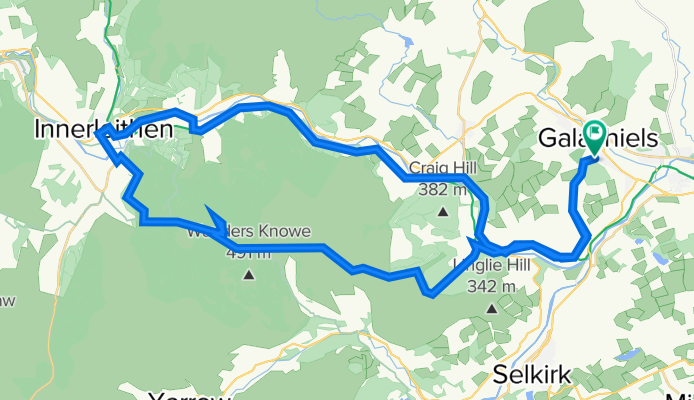
Hello from Scotland ! I live in what are considered rolling hills.. nothing huge, but there are a few peaks in the 600 metres, and over 700 metres if you look toward The Cheviot on the actual border between England and Scotland..but locally it's between 400 metres to 500 and if you know where to look, there are ancient trails, footpaths, sheep herding tracks, and heavens forbid- even roads..that get you to scenic views, and sometimes to gorgeous nooks and crannies. You can idle beside the Tweed and take in the Ancient structures, sample the wilds, you'll find yourself in the Tweed Valley, where some of the best set up trails anywhere are available for your sampling. I love the discovery part of long baron trails, and the cozy, and simultaneously technical trails that are littered from Innerleithen to Peebles..so I pick and chose between them. I can highly recommend this area for cycle adventures..though I personally would chose off road than on- there are some truly spectacular roads such as cycle route 1 that do provide spectacles, challenges, nature and links..between all of the above ! So On Yer Bikes, and see you on the trails ! #LBS

Moje trasy

Zaplanowane i nagrane przejazdy

Kolekcje i wieloetapowe trasy

Odkrywaj

Moje najpopularniejsze trasy

Gala - Yair - Southern Upland - Inners Red and back
Rower górski
Mr. Lance Bumstrong
3

Gala - Yair - Southern Upland - Inners Red and back

Trasa rowerowa w Galashiels, Szkocja, Zjednoczone Królestwo Wielkiej Brytanii

A mixture of ancient footpaths..quiet roads, then a very rad red run at Innerleithen..then return along the Tweed River through Walkerburn and then Cycle Route 1 back towards Galashiels. Long ups, seriously steep down at Innerleithen. A great mixture.
52 km
Dystans
853 m
Przewyższenia
853 m
Spadek
Humbie to Edinburgh via west saulton Railway
Rower szosowyRower górski
Mr. Lance Bumstrong
1

Humbie to Edinburgh via west saulton Railway

Trasa rowerowa w Pencaitland, Szkocja, Zjednoczone Królestwo Wielkiej Brytanii

Roads and connecting gravel path with a small wooded section along the way.
76,1 km
Dystans
350 m
Przewyższenia
350 m
Spadek
Caddonfoot to Glentress Black includes short loop
Rower górski
Mr. Lance Bumstrong
2

Caddonfoot to Glentress Black includes short loop

Trasa rowerowa w Peebles, Szkocja, Zjednoczone Królestwo Wielkiej Brytanii

 A trail diversion cut off some of the fun ups on the Black trail when I got to it, and also slightly shortened the route. This upset the timing of the lap,as I was going for a first run, and wanted to know a baseline time for the whole thing..(oh well ! )  I managed a 2 hour and 12 miniutes on t…
71,6 km
Dystans
750 m
Przewyższenia
756 m
Spadek
Southern Upland heading east towards Longformacus
Rower górski
Mr. Lance Bumstrong
1

Southern Upland heading east towards Longformacus

Trasa rowerowa w Lauder, Szkocja, Zjednoczone Królestwo Wielkiej Brytanii

Mieszanka cichych dróg i ścieżek poza Oxton, a potem na Southern Uplance Way przechodzi się z trawiastych pól do bagnistej wrzosowiny, do kamienistych ścieżek dla owiec... ale nie przed pokonaniem wielu mil pod górę. Trudne, ale dużo dzikiej przyrody dzięki braku ludzi... naprawdę wyjątkowy i odoso…
89,1 km
Dystans
894 m
Przewyższenia
845 m
Spadek

Więcej tras z Zjednoczone Królestwo Wielkiej Brytanii