Portland to Seattle - 2018
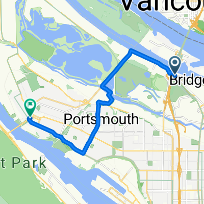
Eine Fahrradroute, die in Vancouver, Washington, Vereinigte Staaten beginnt.
Übersicht
Über diese Route
Rückkehr nach Seattle
Nach unserer Fahrt von Seattle nach Portland (Oregon) beim STP des Cascade Bicycle Club im Jahr 2018 sind wir nach ein paar Ruhetagen wieder nach Seattle geradelt.
Wir haben eine etwas andere Route gewählt, die nach Norden durch Vancouver, Washington, führte und den langen Abschnitt auf der Highway 30 vermied, der Teil der STP-Route nach Portland gewesen war. Insgesamt war dies eine bessere Route. Wir nutzten auch den Inter-Urban Trail, als wir uns Seattle näherten.
Ein Anstieg, der entlang der Green Mountain Road verlief, war sehr steil und eine echte Herausforderung, besonders mit Gepäcktaschen. Gott sei Dank für einen "Oma"-Gang vorne. Sei darauf vorbereitet, gegebenenfalls zu schieben. Ich habe eine sehr grobe Berechnung mit der Reliefkarte von BikeMap gemacht und festgestellt, dass die Steigung für einen Abschnitt von ein paar Hundert Metern des Anstiegs über 20 % betrug.
Wir haben diese Tour in zwei Tagen gemacht und die Nacht in Centralia, Washington, verbracht.
Mit der Ausnahme eines sehr kurzen Abschnitts fand die gesamte Fahrt auf ziemlich gut asphaltierten Straßen statt. Überwiegend waren die Straßen entweder wenig befahren oder stärker befahren mit einem kleinen Seitenstreifen.
- -:--
- Dauer
- 304,5 km
- Distanz
- 896 m
- Aufstieg
- 800 m
- Abstieg
- ---
- Ø-Tempo
- ---
- Max. Höhe
Fotos von der Route
Routenqualität
Wegtypen und Untergründe entlang der Route
Wegtypen
Straße
112,7 km
(37 %)
Radweg
45,7 km
(15 %)
Untergründe
Befestigt
124,8 km
(41 %)
Asphalt
106,6 km
(35 %)
Befestigt (undefiniert)
15,2 km
(5 %)
Weiter mit Bikemap
Diese Radroute verwenden, bearbeiten oder herunterladen
Du möchtest Portland to Seattle - 2018 fahren oder sie für deine eigene Reise anpassen? Folgendes kannst du mit dieser Bikemap-Route machen:
Gratis Funktionen
- Speichere diese Route als Favorit oder in einer Sammlung
- Kopiere & plane deine eigene Version dieser Route
- Teile sie in Etappen ein, um eine mehrtägige Tour zu erstellen
- Synchronisiere deine Route mit Garmin oder Wahoo
Premium-Funktionen
Kostenlose Testversion für 3 Tage oder einmalige Zahlung. Mehr über Bikemap Premium.
- Navigiere diese Route auf iOS & Android
- Exportiere eine GPX / KML-Datei dieser Route
- Erstelle deinen individuellen Ausdruck (Jetzt kostenlos ausprobieren)
- Lade diese Route für die Offline-Navigation herunter
Entdecke weitere Premium-Funktionen.
Bikemap Premium aktivierenVon unserer Community
Vancouver: Andere beliebte Routen, die hier beginnen
 North Portland Trails
- Distanz
- 36,8 km
- Aufstieg
- 156 m
- Abstieg
- 155 m
- Standort
- Vancouver, Washington, Vereinigte Staaten
 Portland to Seattle - 2018
- Distanz
- 304,5 km
- Aufstieg
- 896 m
- Abstieg
- 800 m
- Standort
- Vancouver, Washington, Vereinigte Staaten
 Slow ride in Portland
- Distanz
- 11 km
- Aufstieg
- 4 m
- Abstieg
- 8 m
- Standort
- Vancouver, Washington, Vereinigte Staaten
 W-B17_RooseveltHS-h1
- Distanz
- 4,9 km
- Aufstieg
- 0 m
- Abstieg
- 0 m
- Standort
- Vancouver, Washington, Vereinigte Staaten
 W-B17_RooseveltHS
- Distanz
- 5 km
- Aufstieg
- 0 m
- Abstieg
- 0 m
- Standort
- Vancouver, Washington, Vereinigte Staaten
 Two bridge loop
- Distanz
- 48,9 km
- Aufstieg
- 123 m
- Abstieg
- 124 m
- Standort
- Vancouver, Washington, Vereinigte Staaten
 Two Bridge Loop
- Distanz
- 29,5 km
- Aufstieg
- 136 m
- Abstieg
- 138 m
- Standort
- Vancouver, Washington, Vereinigte Staaten
 Kelley Point
- Distanz
- 26,5 km
- Aufstieg
- 83 m
- Abstieg
- 87 m
- Standort
- Vancouver, Washington, Vereinigte Staaten
In der App öffnen


