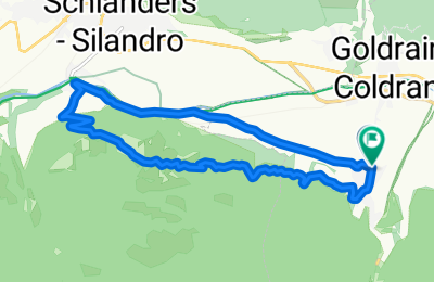
<span style="font-family: Univers; color: black; font-size: 10pt; font-weight: normal; language: de; mso-ascii-font-family: Univers; mso-fareast-font-family: +mn-ea; mso-bidi-font-family: +mn-cs; mso-color-index: 1; mso-font-kerning: 12.0pt;">Erste Eindrücke der </span><span style="font-family: Univers; color: black; font-size: 10pt; font-weight: normal; language: de; mso-ascii-font-family: Univers; mso-fareast-font-family: +mn-ea; mso-bidi-font-family: +mn-cs; mso-color-index: 1; mso-font-kerning: 12.0pt;">Trailanforderungen</span><span style="font-family: Univers; color: black; font-size: 10pt; font-weight: normal; language: de; mso-ascii-font-family: Univers; mso-fareast-font-family: +mn-ea; mso-bidi-font-family: +mn-cs; mso-color-index: 1; mso-font-kerning: 12.0pt;"> im </span><span style="font-family: Univers; color: black; font-size: 10pt; font-weight: normal; language: de; mso-ascii-font-family: Univers; mso-fareast-font-family: +mn-ea; mso-bidi-font-family: +mn-cs; mso-color-index: 1; mso-font-kerning: 12.0pt;">Vinschgau</span><span style="font-family: Univers; color: black; font-size: 10pt; font-weight: normal; language: de; mso-ascii-font-family: Univers; mso-fareast-font-family: +mn-ea; mso-bidi-font-family: +mn-cs; mso-color-index: 1; mso-font-kerning: 12.0pt;"> werden mit dieser Tour vermittelt.</span>
<span style="font-family: Univers; color: black; font-size: 10pt; font-weight: normal; language: de; mso-ascii-font-family: Univers; mso-fareast-font-family: +mn-ea; mso-bidi-font-family: +mn-cs; mso-color-index: 1; mso-font-kerning: 12.0pt;">Von </span><span style="font-family: Univers; color: black; font-size: 10pt; font-weight: normal; language: de; mso-ascii-font-family: Univers; mso-fareast-font-family: +mn-ea; mso-bidi-font-family: +mn-cs; mso-color-index: 1; mso-font-kerning: 12.0pt;">Morter</span><span style="font-family: Univers; color: black; font-size: 10pt; font-weight: normal; language: de; mso-ascii-font-family: Univers; mso-fareast-font-family: +mn-ea; mso-bidi-font-family: +mn-cs; mso-color-index: 1; mso-font-kerning: 12.0pt;"> aus folgen wir kurz der Via Claudia und dann weiter auf dem </span><span style="font-family: Univers; color: black; font-size: 10pt; font-weight: normal; language: de; mso-ascii-font-family: Univers; mso-fareast-font-family: +mn-ea; mso-bidi-font-family: +mn-cs; mso-color-index: 1; mso-font-kerning: 12.0pt;">Trail</span><span style="font-family: Univers; color: black; font-size: 10pt; font-weight: normal; language: de; mso-ascii-font-family: Univers; mso-fareast-font-family: +mn-ea; mso-bidi-font-family: +mn-cs; mso-color-index: 1; mso-font-kerning: 12.0pt;"> an der </span><span style="font-family: Univers; color: black; font-size: 10pt; font-weight: normal; language: de; mso-ascii-font-family: Univers; mso-fareast-font-family: +mn-ea; mso-bidi-font-family: +mn-cs; mso-color-index: 1; mso-font-kerning: 12.0pt;">Bahnline</span><span style="font-family: Univers; color: black; font-size: 10pt; font-weight: normal; language: de; mso-ascii-font-family: Univers; mso-fareast-font-family: +mn-ea; mso-bidi-font-family: +mn-cs; mso-color-index: 1; mso-font-kerning: 12.0pt;"> bis </span><span style="font-family: Univers; color: black; font-size: 10pt; font-weight: normal; language: de; mso-ascii-font-family: Univers; mso-fareast-font-family: +mn-ea; mso-bidi-font-family: +mn-cs; mso-color-index: 1; mso-font-kerning: 12.0pt;">Göflan</span><span style="font-family: Univers; color: black; font-size: 10pt; font-weight: normal; language: de; mso-ascii-font-family: Univers; mso-fareast-font-family: +mn-ea; mso-bidi-font-family: +mn-cs; mso-color-index: 1; mso-font-kerning: 12.0pt;">. Hier geht es jetzt ca. 300 Hm auf Asphalt bergauf, bevor es dann<span style="mso-spacerun: yes;"> </span>links<span style="mso-spacerun: yes;"> </span>zurück in Richtung </span><span style="font-family: Univers; color: black; font-size: 10pt; font-weight: normal; language: de; mso-ascii-font-family: Univers; mso-fareast-font-family: +mn-ea; mso-bidi-font-family: +mn-cs; mso-color-index: 1; mso-font-kerning: 12.0pt;">Morter</span><span style="font-family: Univers; color: black; font-size: 10pt; font-weight: normal; language: de; mso-ascii-font-family: Univers; mso-fareast-font-family: +mn-ea; mso-bidi-font-family: +mn-cs; mso-color-index: 1; mso-font-kerning: 12.0pt;"> geht. Der Weg Nr. 4 ist ein interessanter </span><span style="font-family: Univers; color: black; font-size: 10pt; font-weight: normal; language: de; mso-ascii-font-family: Univers; mso-fareast-font-family: +mn-ea; mso-bidi-font-family: +mn-cs; mso-color-index: 1; mso-font-kerning: 12.0pt;">Trail</span><span style="font-family: Univers; color: black; font-size: 10pt; font-weight: normal; language: de; mso-ascii-font-family: Univers; mso-fareast-font-family: +mn-ea; mso-bidi-font-family: +mn-cs; mso-color-index: 1; mso-font-kerning: 12.0pt;"> der erahnen lässt, was das </span><span style="font-family: Univers; color: black; font-size: 10pt; font-weight: normal; language: de; mso-ascii-font-family: Univers; mso-fareast-font-family: +mn-ea; mso-bidi-font-family: +mn-cs; mso-color-index: 1; mso-font-kerning: 12.0pt;">Vinschgau</span><span style="font-family: Univers; color: black; font-size: 10pt; font-weight: normal; language: de; mso-ascii-font-family: Univers; mso-fareast-font-family: +mn-ea; mso-bidi-font-family: +mn-cs; mso-color-index: 1; mso-font-kerning: 12.0pt;"> noch zu bieten hat.</span>