
2020
A cycling tour with 5 stages, starting in Linz, Upper Austria, Austria.
Overview
About this tour
This cycling tour has 5 stages and a total length of 421.1 km.
- 5
- Routes
- -:--
- Duration
- 421.1 km
- Distance
- ---
- Avg. speed
- 1,891 m
- Ascent
- 1,889 m
- Descent
2020
Stages of this tour
All 5 stages of this tour can be opened on the map or in the Bikemap App for more details, where you can adjust them in the route planner or download them as GPX or KML file. Use them as a template for planning your own tour, or let Bikemap navigate you along them directly.
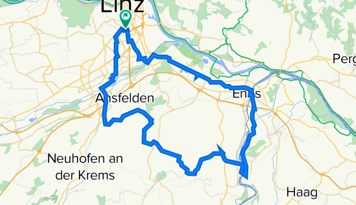
Linz-Nettingsdorf-Hofkirchen-Ernsthofen-Enns
Cycling route in Linz, Upper Austria, Austria
Linz - Nettingsdorf - Hofkirchen - Kronsdorf -Ernsthofen - Enns - Lint
- 73.6 km
- Distance
- 231 m
- Ascent
- 231 m
- Descent
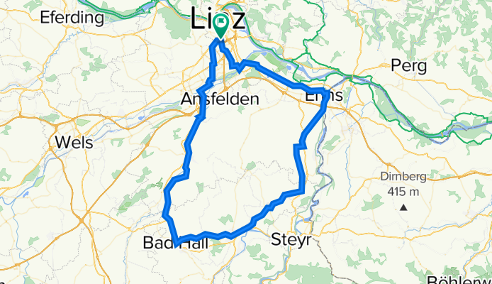
Linz-Enns-Bad Hall-Nettingsdorf-Linz
Cycling route in Linz, Upper Austria, Austria
ALTERNATIVE:
Die Runde kann ohne Probleme direkt von TRAUN bis EBELSBERG am TRAUNRADWEG gefahren werden. Somit iat ein Einstig an jedem beliebigen Punkt der Strecke möglich-
- 92.2 km
- Distance
- 301 m
- Ascent
- 301 m
- Descent
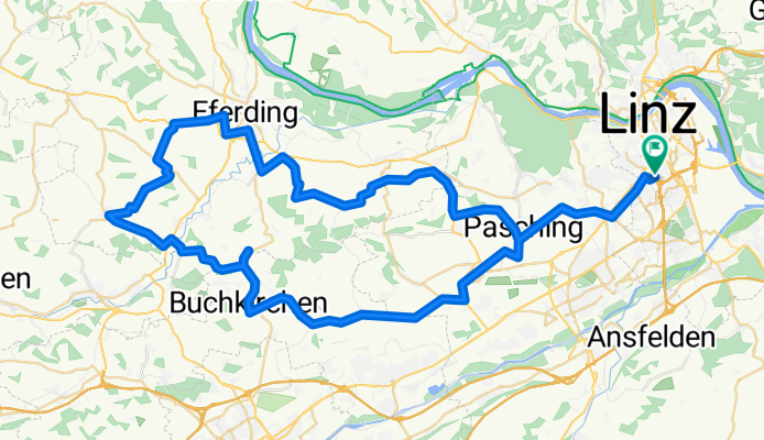
Espresso Runde ins Cafe Kronberg+
Cycling route in Linz, Upper Austria, Austria
weniger auf Hauptstraße.
Öffnungszeiten: Mi. bis So. (auch Feiertags) 10 bis 22 Uhr
Warme Küche: 12 bis 14 Uhr und 18 bis 21 Uhr, an Sonn-/Feiertagen: 11.30 bis 14 Uhr und 17.30 bis 20.30 Uhr
- 81.2 km
- Distance
- 425 m
- Ascent
- 423 m
- Descent
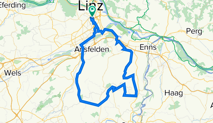
Linz-Tyllisburg-Hagelsber-Schiedlberg-Traun
Cycling route in Linz, Upper Austria, Austria
- 82.1 km
- Distance
- 256 m
- Ascent
- 256 m
- Descent
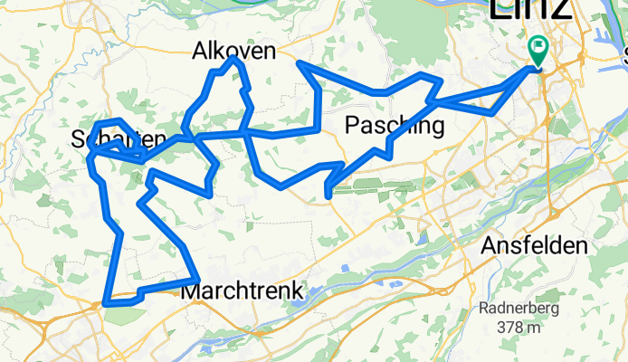
Schlechtwetter Variante
Cycling route in Linz, Upper Austria, Austria
Die Strecke ist von Daniel P.
SCHLECHTwetter Strecke! Bietet viele Möglichkeiten abzukürzen sollte das Wetter schlechter werden!
Es werden schon 950hm werden
- 92.1 km
- Distance
- 678 m
- Ascent
- 678 m
- Descent