
Three main rivers
Three Rivers Cycle Route – Main Line
A collection of 2 cycling routes.
Overview
About this collection
A relaxed, river‑to‑river ride in Hungary. The Three Rivers (Három folyó) main line links riversides and small towns over roughly 103 km of almost fully paved terrain. Climbing is mild (around 310 m), so you can just spin and enjoy the scenery. You’ll get a good mix: plenty of dedicated cycle paths, quiet backroads, and a few busier stretches—bring lights and ride alert where traffic picks up.
It works fine in either direction and is easy to do in a day if you’re keen, or split into two for a slower tour. Road, touring, and e‑bikes are perfect; there are only a couple of short unpaved bits. Expect regular villages for water and snacks, and plenty of riverside spots for breaks.
Ideal for riders who like steady cruising without gravel or technical sections. Follow local Három folyó waymarks where you see them, keep an eye out near the busier road segments, and enjoy the blend of river vibes and easy countryside riding.
- 2
- Routes
- -:--
- Duration
- 108 km
- Distance
- ---
- Avg. speed
- 310 m
- Ascent
- 311 m
- Descent
Three Rivers Cycle Route – Main Line
Routes in this collection
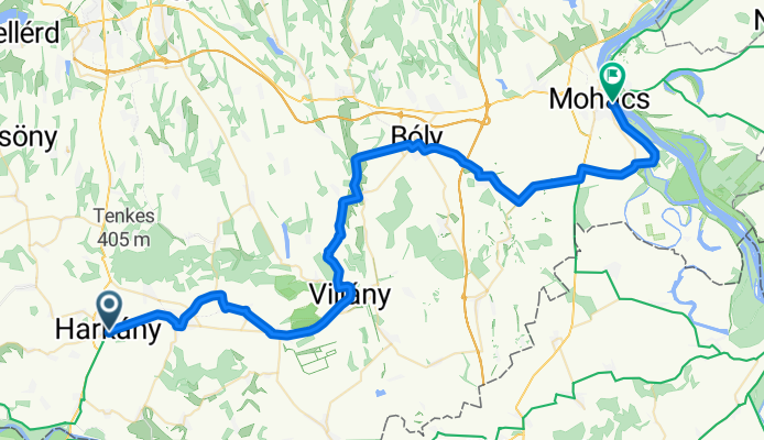
Három folyó Harkány – Mohács fővonal
Cycling route in Harkány, Baranya, Hungary
- 64.5 km
- Distance
- 224 m
- Ascent
- 231 m
- Descent

Három folyó: Virovitica - Sellye
Cycling route in Virovitica, Virovitica-Podravina County, Croatia
- 43.5 km
- Distance
- 86 m
- Ascent
- 81 m
- Descent