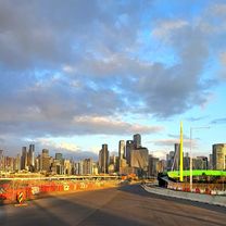
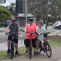
From our community
Top cycling routes worldwide
From mountain passes to forest loops — these are the most-loved routes from cyclists around the globe. Explore popular routes or plan your own adventure.
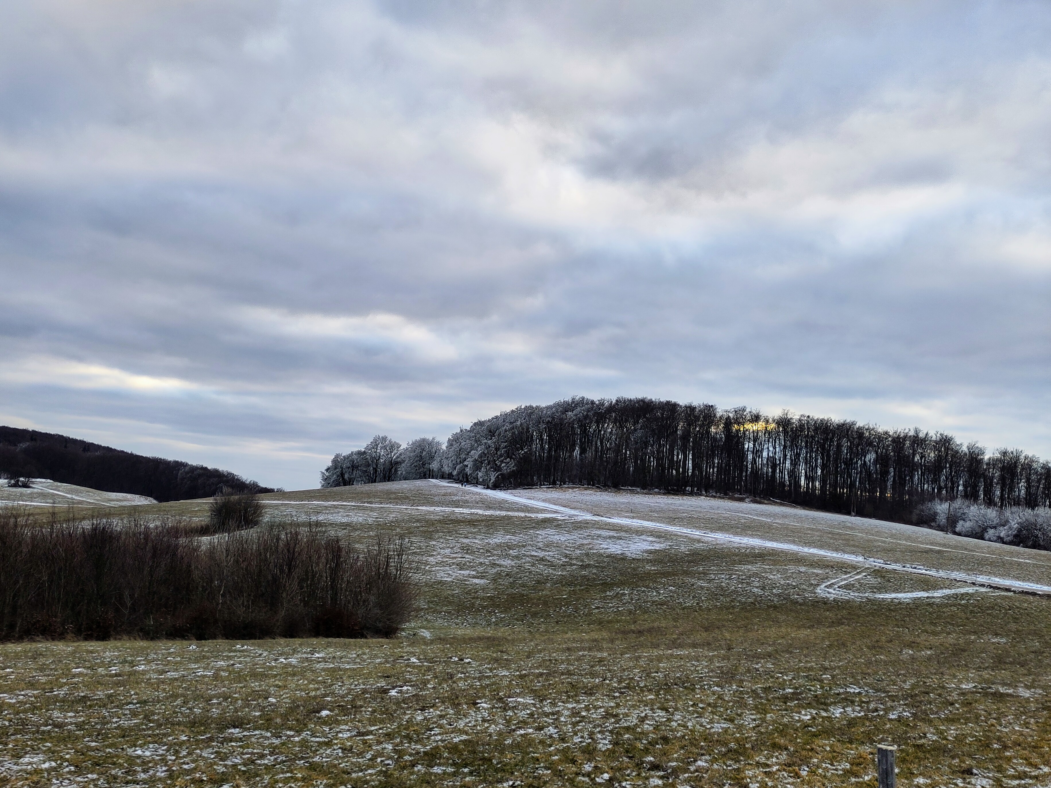 Leicht Winterliche Sofienalpen-Runde
- Distance
- 17 km
- Ascent
- 554 m
- Descent
- 604 m
- Location
- Purkersdorf, Lower Austria, Austria
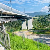 Ruden Ratschitschach St. Michael Jauntalbrücke
- Distance
- 45 km
- Ascent
- 797 m
- Descent
- 828 m
- Location
- Ruden, Carinthia, Austria
 GROR Route
- Distance
- 9.1 km
- Ascent
- 67 m
- Descent
- 70 m
- Location
- Hamilton, Ontario, Canada
 Cottage Ave, Mount Vernon to Old Kings Hwy, Old Greenwich
- Distance
- 37.8 km
- Ascent
- 398 m
- Descent
- 419 m
- Location
- Mount Vernon, New York, United States
 Pismo Beach to Avila Beach
- Distance
- 15.5 km
- Ascent
- 218 m
- Descent
- 220 m
- Location
- Pismo Beach, California, United States
 Route to San Gabriel Drive
- Distance
- 8.4 km
- Ascent
- 56 m
- Descent
- 58 m
- Location
- Cupertino, California, United States
 De Caminho 4a Etapa a Caminho 4a Etapa
- Distance
- 6.4 km
- Ascent
- 47 m
- Descent
- 48 m
- Location
- Salvador, Estado de Bahia, Brazil
 De Calle 6f 1A-28 a Avenida Carrera # 116-4
- Distance
- 14.1 km
- Ascent
- 264 m
- Descent
- 350 m
- Location
- Bogotá, Bogota D.C., Colombia
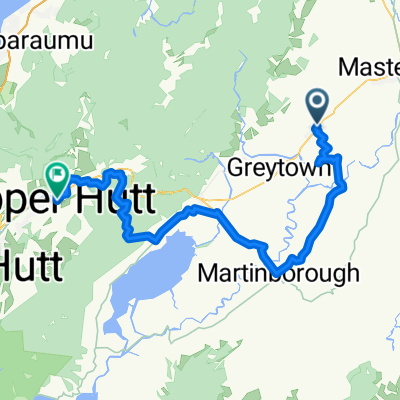 From Carterton to Ebdentown
- Distance
- 93.3 km
- Ascent
- 1,327 m
- Descent
- 1,342 m
- Location
- Masterton, Wellington Region, New Zealand
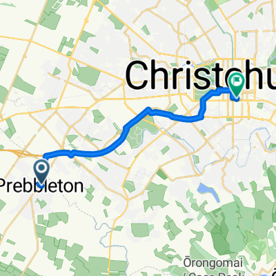 Stationmasters Way, Prebbleton to Pilgrim Pl, Christchurch
- Distance
- 14.8 km
- Ascent
- 20 m
- Descent
- 31 m
- Location
- Prebbleton, Canterbury, New Zealand
 Wakefield Street to Kooyongkoot Road
- Distance
- 31.8 km
- Ascent
- 158 m
- Descent
- 184 m
- Location
- Hawthorn East, Victoria, Australia
 Ocean Drive to Ocean Drive
- Distance
- 22.2 km
- Ascent
- 91 m
- Descent
- 132 m
- Location
- Sunshine Coast, Queensland, Australia
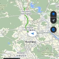 남산동 1-2 ~ 광안동 733-1
- Distance
- 16.4 km
- Ascent
- 314 m
- Descent
- 334 m
- Location
- Yangsan, Gyeongsangnam-do, South Korea
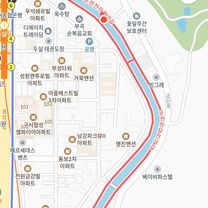 광안동 536-144 ~ 구서동 175-24
- Distance
- 16.5 km
- Ascent
- 379 m
- Descent
- 390 m
- Location
- Busan, Busan, South Korea
 2025/09/19
- Distance
- 5.2 km
- Ascent
- 343 m
- Descent
- 259 m
- Location
- Jaffna, Northern Province, Sri Lanka
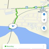
 2025.09.19. දින. 1700 සිට 1900
- Distance
- 7.9 km
- Ascent
- 52 m
- Descent
- 56 m
- Location
- Valvettithurai, Northern Province, Sri Lanka
 bypass ambohimalaza anjeva stèle vohitsara tsaronenana imerkiasina pedro
- Distance
- 52.8 km
- Ascent
- 1,747 m
- Descent
- 1,068 m
- Location
- Antananarivo, Analamanga Region, Madagascar
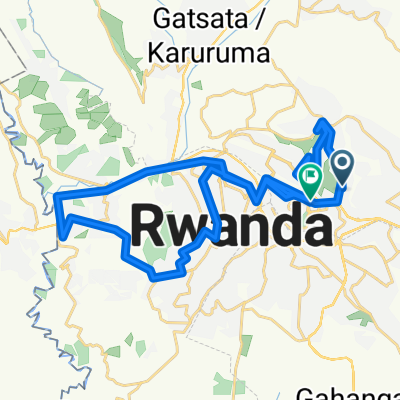 UCI 2025 Loops 1 + 2 Kigali
- Distance
- 56.2 km
- Ascent
- 1,362 m
- Descent
- 1,341 m
- Location
- Kigali, Kigali, Rwanda
 EA24 Day1 Hatfield Peverel - Colchester
- Distance
- 47.5 km
- Ascent
- 246 m
- Descent
- 274 m
- Location
- Hatfield Peverel, England, United Kingdom
 EA24: Day 2 Colchester - Felixstowe
- Distance
- 82.9 km
- Ascent
- 415 m
- Descent
- 424 m
- Location
- Colchester, England, United Kingdom