For your gravel bike
Explore the world’s best gravel routes
From alpine fire roads to coastal forest trails—these are the top-rated gravel routes from the Bikemap community. Get inspired and start planning your next ride.
 Lubnik (Skofja Loka) til Blegos - Hobbit-land
- Distance
- 54.1 km
- Ascent
- 1,064 m
- Descent
- 1,082 m
- Location
- Škofja Loka, Škofja Loka, Slovenia
 Wangen - Friedrichshafen - Eriskirch - Kressbronn - Wangen
- Distance
- 75.8 km
- Ascent
- 913 m
- Descent
- 913 m
- Location
- Wangen im Allgäu, Baden-Württemberg, Germany
 Pond to Lake to Pond
- Distance
- 37.6 km
- Ascent
- 112 m
- Descent
- 115 m
- Location
- Richmond Hill, Ontario, Canada
 101–111 Rue des Saisons, Sainte-Anne-des-Plaines à 127 Rue des Frênes, Sainte-Anne-des-Plaines
- Distance
- 57.4 km
- Ascent
- 170 m
- Descent
- 172 m
- Location
- Sainte-Anne-des-Plaines, Quebec, Canada
 53 km Okanagan Rail Trail Loop from Coldstream
- Distance
- 53.5 km
- Ascent
- 493 m
- Descent
- 494 m
- Location
- Vernon, British Columbia, Canada
 Coquitlam to Harrison Hot Springs
- Distance
- 99.5 km
- Ascent
- 459 m
- Descent
- 459 m
- Location
- Coquitlam, British Columbia, Canada
 Ruta tranquila en
- Distance
- 30.4 km
- Ascent
- 2,423 m
- Descent
- 2,381 m
- Location
- Ipiales, Departamento de Nariño, Colombia
 Salado Doima Piedras Tebaida San Bernardo Salado
- Distance
- 103.4 km
- Ascent
- 1,151 m
- Descent
- 1,150 m
- Location
- Ibagué, Departamento de Tolima, Colombia
 Hawea-Wanaka-Glenghu
- Distance
- 40.4 km
- Ascent
- 3,200 m
- Descent
- 2,255 m
- Location
- Wanaka, Otago, New Zealand
 NZ Cycle (Day 11)
- Distance
- 135.9 km
- Ascent
- 910 m
- Descent
- 1,023 m
- Location
- Masterton, Wellington, New Zealand
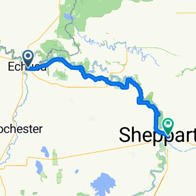
 Echuca - Mooroopna
- Distance
- 95.2 km
- Ascent
- 272 m
- Descent
- 249 m
- Location
- Echuca, Victoria, Australia
 Echuca - Mooroopna
- Distance
- 95.2 km
- Ascent
- 272 m
- Descent
- 249 m
- Location
- Echuca, Victoria, Australia
 19-06-2010太平至中山
- Distance
- 72 km
- Ascent
- 122 m
- Descent
- 131 m
- Location
- Humen, Guangdong, China
 肇慶-梧州01
- Distance
- 93.7 km
- Ascent
- 609 m
- Descent
- 607 m
- Location
- Chengbei, Guangdong, China
 Adiyogi 2022 Personal Route 50Kms
- Distance
- 50.9 km
- Ascent
- 1,155 m
- Descent
- 1,215 m
- Location
- Valsād, Gujarat, India
 Kalba circuit
- Distance
- 41.5 km
- Ascent
- 388 m
- Descent
- 387 m
- Location
- Fujairah, Al Fujayrah, United Arab Emirates
 Paarl berg
- Distance
- 31.3 km
- Ascent
- 326 m
- Descent
- 325 m
- Location
- Paarl, Province of the Western Cape, Republic of South Africa
 De RN2,sommet anjeva imerkiasina bypass
- Distance
- 36.7 km
- Ascent
- 1,822 m
- Descent
- 1,824 m
- Location
- Antananarivo, Analamanga Region, Madagascar
 Surbiton to Oxford v2
- Distance
- 136.6 km
- Ascent
- 683 m
- Descent
- 635 m
- Location
- Ditton Hill, England, United Kingdom
 NCN 21: Horley to Biggin Hill
- Distance
- 33.4 km
- Ascent
- 309 m
- Descent
- 427 m
- Location
- Horley, England, United Kingdom