For your gravel bike
Explore the world’s best gravel routes
From alpine fire roads to coastal forest trails—these are the top-rated gravel routes from the Bikemap community. Get inspired and start planning your next ride.
 🚴♀️E*Bike🇩🇪 16.08.28. Haslinger Hof Runde
- Distance
- 49.3 km
- Ascent
- 104 m
- Descent
- 106 m
- Location
- Neuburg, Bavaria, Germany
 🚴♀️E*Bike🇮🇩 Schlanders - Meran - Bozen
- Distance
- 69.2 km
- Ascent
- 127 m
- Descent
- 612 m
- Location
- Schlanders, Trentino-Alto Adige, Italy
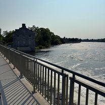 Rue de L'Île-des-Gardes, Terrebonne to Rue de L'Île-des-Gardes, Terrebonne
- Distance
- 45.1 km
- Ascent
- 191 m
- Descent
- 191 m
- Location
- Terrebonne, Quebec, Canada
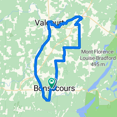 La petite champêtre, Bonsecours
- Distance
- 39.3 km
- Ascent
- 339 m
- Descent
- 348 m
- Location
- Valcourt, Quebec, Canada
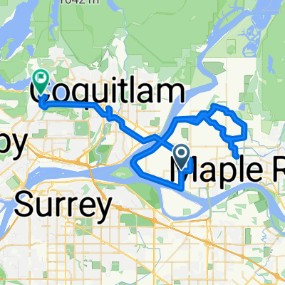 Ford Rd, Pitt Meadows to Princeton Ave, Port Moody
- Distance
- 69.4 km
- Ascent
- 255 m
- Descent
- 136 m
- Location
- Pitt Meadows, British Columbia, Canada
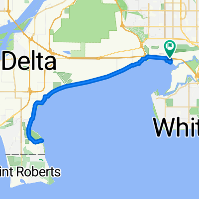 Boundary Bay Dyke
- Distance
- 42.4 km
- Ascent
- 29 m
- Descent
- 8 m
- Location
- Surrey, British Columbia, Canada
 Calderon-Grumbein-Espora-Seminario
- Distance
- 39 km
- Ascent
- 147 m
- Descent
- 147 m
- Location
- Bahía Blanca, Buenos Aires, Argentina
 Volcán Chimborazo - Urbina
- Distance
- 41.7 km
- Ascent
- 424 m
- Descent
- 1,661 m
 Totara Street 3, Nelson to Clifford Road 12, Wakefield
- Distance
- 31.8 km
- Ascent
- 157 m
- Descent
- 111 m
- Location
- Nelson, Nelson, New Zealand
 Inland Kaikoura Road, Inland Road to Inland Kaikoura Road, Inland Road
- Distance
- 57.1 km
- Ascent
- 2,330 m
- Descent
- 2,381 m
- Location
- Kaikoura, Canterbury, New Zealand
 the path of reckoning
- Distance
- 33.7 km
- Ascent
- 150 m
- Descent
- 150 m
- Location
- Dandenong, Victoria, Australia
 Tweed heads to byron Tour off road
- Distance
- 65.9 km
- Ascent
- 91 m
- Descent
- 125 m
- Location
- Banora Point, New South Wales, Australia
 🇯🇵 JPN D01b-02 HIROSHIMA + MIJAJIMA
- Distance
- 78.1 km
- Ascent
- 608 m
- Descent
- 605 m
- Location
- Hiroshima, Hiroshima, Japan
 肇慶-梧州02
- Distance
- 70.1 km
- Ascent
- 530 m
- Descent
- 549 m
- Location
- Decheng, Guangdong, China
 sample
- Distance
- 119.2 km
- Ascent
- 254 m
- Descent
- 602 m
- Location
- Lāsalgaon, Maharashtra, India
 allagadda
- Distance
- 41.1 km
- Ascent
- 35 m
- Descent
- 22 m
 Baden - Epic challenge
- Distance
- 51.5 km
- Ascent
- 518 m
- Descent
- 515 m
- Location
- Ashton, Province of the Western Cape, Republic of South Africa
 Chibuluma to Kafue River
- Distance
- 57.8 km
- Ascent
- 235 m
- Descent
- 233 m
- Location
- Kalulushi, Copperbelt, Zambia
 south East London - londra2 CLONED
- Distance
- 45.2 km
- Ascent
- 139 m
- Descent
- 142 m
- Location
- Brixton Hill, England, United Kingdom
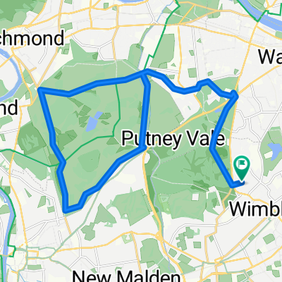 Richmond Park Loop
- Distance
- 34.5 km
- Ascent
- 213 m
- Descent
- 212 m
- Location
- Earlsfield, England, United Kingdom