For your mountain bike
Shred the world’s best mountain bike trails
From rooty forest loops to alpine descents—these are the highest-rated MTB routes shared by riders like you. Get ready to ride.
 Salzburger Seenrunde
- Distance
- 70.6 km
- Ascent
- 923 m
- Descent
- 921 m
- Location
- Bergheim, Salzburg, Austria
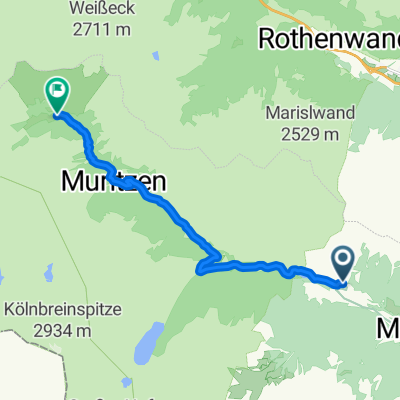 Murradweg linkes Ufer – Zederhaus – Muhr
- Distance
- 11.4 km
- Ascent
- 859 m
- Descent
- 311 m
- Location
- Zederhaus, Salzburg, Austria
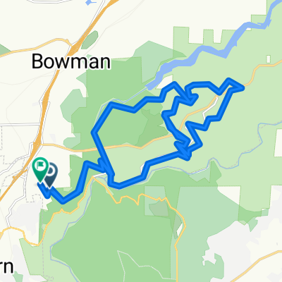
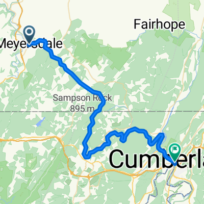 Meyersdale - Cumberland
- Distance
- 52.1 km
- Ascent
- 1,066 m
- Descent
- 1,481 m
- Location
- Meyersdale, Pennsylvania, United States of America
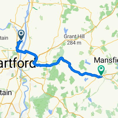 Windsor - Willimantic
- Distance
- 54.8 km
- Ascent
- 472 m
- Descent
- 408 m
- Location
- Windsor, Connecticut, United States of America
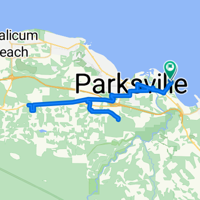 Route in Parksville
- Distance
- 38.4 km
- Ascent
- 471 m
- Descent
- 472 m
- Location
- Parksville, British Columbia, Canada
 Upper Stagecoach Trail, Auburn to Russell Loop, Auburn
- Distance
- 28.6 km
- Ascent
- 1,103 m
- Descent
- 1,079 m
- Location
- Auburn, California, United States of America
 DESAFIO RURAL FAST #1 GUARAREMA
- Distance
- 64.8 km
- Ascent
- 646 m
- Descent
- 646 m
- Location
- Guararema, São Paulo, Brazil
 Vuelta Altas Cumbres
- Distance
- 74.6 km
- Ascent
- 1,419 m
- Descent
- 1,232 m
- Location
- Mina Clavero, Cordoba Province, Argentina
 Arrowtown to Twin Rivers Trail and return to Arrowtown
- Distance
- 32.7 km
- Ascent
- 495 m
- Descent
- 495 m
- Location
- Arrowtown, Otago, New Zealand
 Ruby Bay to Kaiteriteri
- Distance
- 40.3 km
- Ascent
- 407 m
- Descent
- 403 m
- Location
- Mapua, Tasman, New Zealand
 Northern NSW hinterland ride to waterfall
- Distance
- 19.5 km
- Ascent
- 478 m
- Descent
- 206 m
- Location
- Brunswick Heads, New South Wales, Australia
 Sunshine to Footscray (via Brimbank Park)
- Distance
- 38 km
- Ascent
- 422 m
- Descent
- 439 m
- Location
- Sunshine West, Victoria, Australia
 兩日一夜行程
- Distance
- 19.6 km
- Ascent
- 566 m
- Descent
- 619 m
- Location
- Sai Kung, Sai Kung District, Hong Kong
 地利丹大林道二分所檢查哨
- Distance
- 16.2 km
- Ascent
- 1,281 m
- Descent
- 705 m
- Location
- Puli, Taiwan, Taiwan
 8 Cross 50km
- Distance
- 49.9 km
- Ascent
- 445 m
- Descent
- 447 m
- Location
- Bengaluru, Karnataka, India
 Adiyogi 2022 Personal Route 50Kms
- Distance
- 50.9 km
- Ascent
- 1,155 m
- Descent
- 1,215 m
- Location
- Valsād, Gujarat, India
 Jozi to Home
- Distance
- 37.2 km
- Ascent
- 44,424 m
- Descent
- 44,581 m
- Location
- Johannesburg, Gauteng, Republic of South Africa
 Bypass imerkiasina anjeva ambatomanga barage tsaronena bypass
- Distance
- 60.5 km
- Ascent
- 925 m
- Descent
- 939 m
- Location
- Antananarivo, Analamanga Region, Madagascar
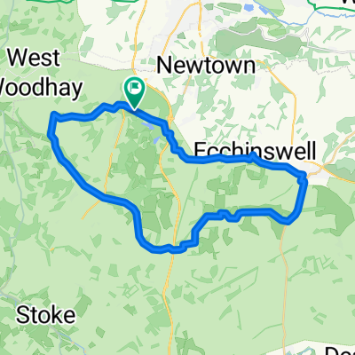 Route in Newbury
- Distance
- 33.6 km
- Ascent
- 475 m
- Descent
- 475 m
- Location
- Highclere, England, United Kingdom
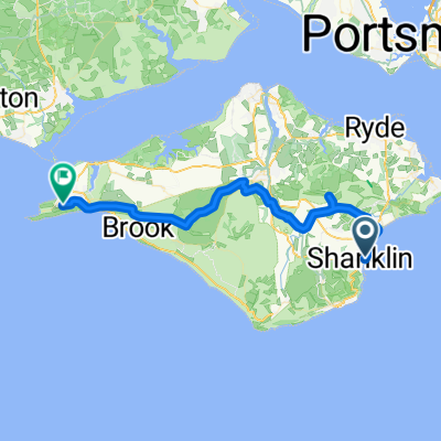 Esplanade, Shanklin to Highdown Lane, Totland Bay
- Distance
- 41.1 km
- Ascent
- 518 m
- Descent
- 479 m
- Location
- Shanklin, England, United Kingdom