For your mountain bike
Shred the world’s best mountain bike trails
From rooty forest loops to alpine descents—these are the highest-rated MTB routes shared by riders like you. Get ready to ride.
 Route in Sankt Michael im Lungau
- Distance
- 31.9 km
- Ascent
- 1,657 m
- Descent
- 1,659 m
- Location
- St Michael im Lungau, Salzburg, Austria
 Obertrum/Mattsee round
- Distance
- 32.5 km
- Ascent
- 434 m
- Descent
- 341 m
- Location
- Oberndorf bei Salzburg, Salzburg, Austria
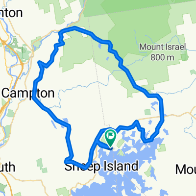 RDC to Sandwich notch, Campton, ret via Mt Road
- Distance
- 53.6 km
- Ascent
- 1,278 m
- Descent
- 1,276 m
- Location
- Holderness, New Hampshire, United States of America
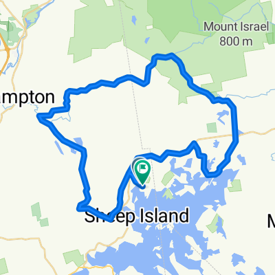 Sandwich Notch to Bebee River
- Distance
- 44.6 km
- Ascent
- 933 m
- Descent
- 941 m
- Location
- Holderness, New Hampshire, United States of America
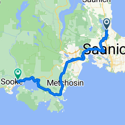 Cherry Tree Bend to Phillips Road
- Distance
- 52.2 km
- Ascent
- 472 m
- Descent
- 519 m
- Location
- Victoria, British Columbia, Canada
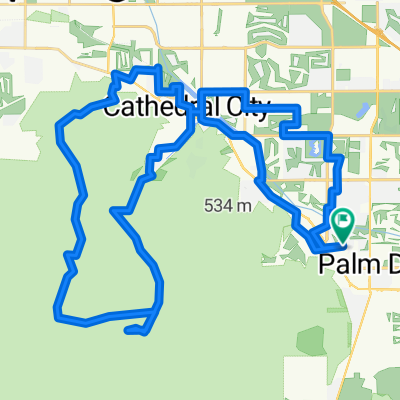 Joshua Rd, Rancho Mirage to Joshua Rd, Rancho Mirage
- Distance
- 60.5 km
- Ascent
- 1,283 m
- Descent
- 1,283 m
- Location
- Rancho Mirage, California, United States of America
 Santa Rosa de Lima to Anitápolis
- Distance
- 31.3 km
- Ascent
- 1,225 m
- Descent
- 1,015 m
- Location
- Anitápolis, Santa Catarina, Brazil
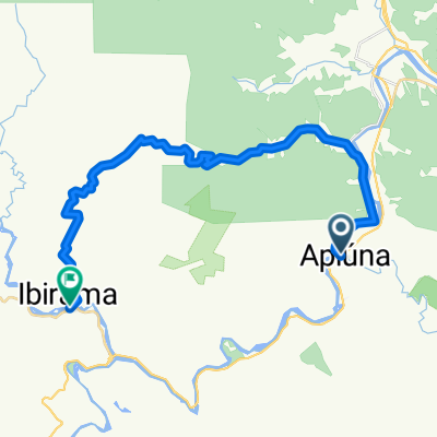 Apiúna to Ibirama
- Distance
- 32.9 km
- Ascent
- 1,054 m
- Descent
- 983 m
- Location
- Ibirama, Santa Catarina, Brazil
 Lake Moke
- Distance
- 35 km
- Ascent
- 609 m
- Descent
- 633 m
- Location
- Queenstown, Otago, New Zealand
 (1h45) Queenstown / Jacks Point / Queenstown
- Distance
- 43.4 km
- Ascent
- 467 m
- Descent
- 467 m
- Location
- Queenstown, Otago, New Zealand
 TRIYME 1hr10m
- Distance
- 14.3 km
- Ascent
- 1,058 m
- Descent
- 1,057 m
- Location
- Narre Warren North, Victoria, Australia
 Warrandyte loop
- Distance
- 44.1 km
- Ascent
- 531 m
- Descent
- 531 m
- Location
- North Warrandyte, Victoria, Australia
 Ride with Jorgen
- Distance
- 36.1 km
- Ascent
- 510 m
- Descent
- 502 m
- Location
- Shiyan, Guangdong, China
 大埔-烏蛟騰-三椏涌-三椏村-荔枝窩-分水坳-谷埔-鳳坑-鹿頸-大埔
- Distance
- 32 km
- Ascent
- 456 m
- Descent
- 531 m
- Location
- Tai Po, Tai Po District, Hong Kong
 Around Armala Khota - Pokhara
- Distance
- 37.2 km
- Ascent
- 941 m
- Descent
- 989 m
- Location
- Pokhara, Western Region, Nepal
 Mae Sariang-Salawin River Burmese Border
- Distance
- 38.4 km
- Ascent
- 825 m
- Descent
- 958 m
- Location
- Ban Huai I Huak, Changwat Mae Hong Son, Thailand
 talata volonondry
- Distance
- 61.1 km
- Ascent
- 1,201 m
- Descent
- 1,247 m
- Location
- Antananarivo, Analamanga Region, Madagascar
 Charles Street to R404
- Distance
- 42.1 km
- Ascent
- 491 m
- Descent
- 496 m
- Location
- George, Province of the Western Cape, Republic of South Africa
 rotherhithe to grenwich
- Distance
- 14.6 km
- Ascent
- 709 m
- Descent
- 711 m
- Location
- Canary Wharf, England, United Kingdom
 thames path
- Distance
- 33.2 km
- Ascent
- 1,510 m
- Descent
- 1,508 m
- Location
- Canary Wharf, England, United Kingdom