For your mountain bike
Shred the world’s best mountain bike trails
From rooty forest loops to alpine descents—these are the highest-rated MTB routes shared by riders like you. Get ready to ride.
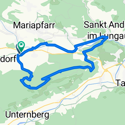 Pichl Mitterberg
- Distance
- 16.2 km
- Ascent
- 435 m
- Descent
- 466 m
- Location
- Mariapfarr, Salzburg, Austria
 Grießenkar - Mayrdörfl
- Distance
- 23.7 km
- Ascent
- 911 m
- Descent
- 911 m
- Location
- Flachau, Salzburg, Austria
 From Branchwood, Bella Vista, Clockwise
- Distance
- 27.1 km
- Ascent
- 422 m
- Descent
- 422 m
- Location
- Bella Vista, Arkansas, United States of America
 199 Polly Drummond Hill Rd, Newark to 199 Polly Drummond Hill Rd, Newark
- Distance
- 22.7 km
- Ascent
- 493 m
- Descent
- 491 m
- Location
- Pike Creek, Delaware, United States of America
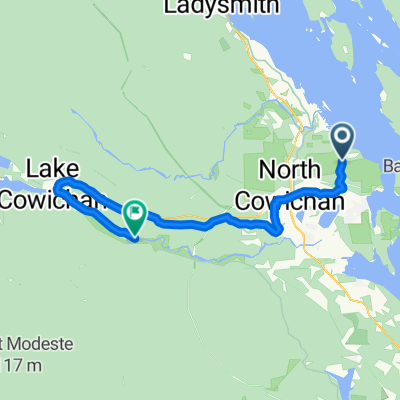 North Cowichan - Lake Cowichan
- Distance
- 50.3 km
- Ascent
- 529 m
- Descent
- 490 m
- Location
- North Cowichan, British Columbia, Canada
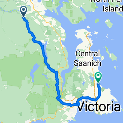 Duncan - Oak Bay
- Distance
- 68.3 km
- Ascent
- 1,006 m
- Descent
- 1,061 m
- Location
- Duncan, British Columbia, Canada
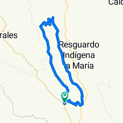 San pedro
- Distance
- 35.4 km
- Ascent
- 766 m
- Descent
- 795 m
- Location
- Cajibío, Departamento del Cauca, Colombia
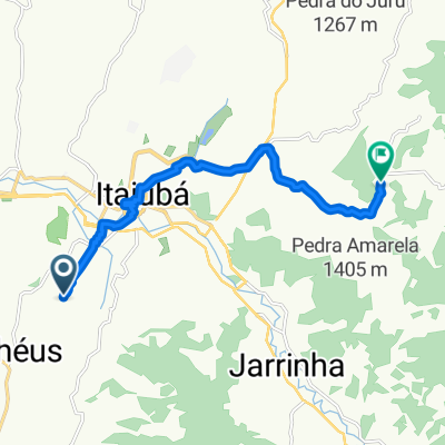 Rota desde Rua Professor Dário Gargaglione
- Distance
- 12.4 km
- Ascent
- 435 m
- Descent
- 280 m
- Location
- Itajubá, Minas Gerais, Brazil
 Kepler - The Adventure Sport Specialist
- Distance
- 66.2 km
- Ascent
- 2,364 m
- Descent
- 2,364 m
- Location
- Te Anau, Southland, New Zealand
 Final day: Whanganui to Hunterville
- Distance
- 64 km
- Ascent
- 659 m
- Descent
- 398 m
 Communication to McLaren Flat
- Distance
- 38.6 km
- Ascent
- 412 m
- Descent
- 411 m
- Location
- Port Willunga, South Australia, Australia
 Archer camping area to The Gantry
- Distance
- 29.1 km
- Ascent
- 1,140 m
- Descent
- 1,142 m
- Location
- Woodford, Queensland, Australia
 Recovered Route
- Distance
- 55.2 km
- Ascent
- 490 m
- Descent
- 489 m
- Location
- Kuroda, Aichi, Japan
 분평동 3, 청주시 to 용암동 770−41, 청주시
- Distance
- 68.5 km
- Ascent
- 957 m
- Descent
- 947 m
- Location
- Cheongju-si, Chungcheongbuk-do, Republic of Korea
 Indian Defence 2022 25Kms+ Personal Route
- Distance
- 36.7 km
- Ascent
- 1,095 m
- Descent
- 1,170 m
- Location
- Jalālpur, Gujarat, India
 Garmur Road, Jorhat to Unnamed Road, Jorhat
- Distance
- 13 km
- Ascent
- 523 m
- Descent
- 355 m
- Location
- Jorhāt, Assam, India
 Ou Dam en Tierkop
- Distance
- 33.6 km
- Ascent
- 728 m
- Descent
- 731 m
- Location
- George, Province of the Western Cape, Republic of South Africa
 DAG 1 SEVENPASSES
- Distance
- 58.6 km
- Ascent
- 599 m
- Descent
- 810 m
 MPS lost marbles quest
- Distance
- 30.7 km
- Ascent
- 1,072 m
- Descent
- 1,083 m
- Location
- Hammersmith, England, United Kingdom
 Haydn Avenue 99 to Haydn Avenue 99
- Distance
- 18.8 km
- Ascent
- 468 m
- Descent
- 465 m
- Location
- Purley, England, United Kingdom