For your mountain bike
Shred the world’s best mountain bike trails
From rooty forest loops to alpine descents—these are the highest-rated MTB routes shared by riders like you. Get ready to ride.
 Z Molina di Ledro k Lago di Ampola a zpět přes Riva del Garda do Nago Torbole
- Distance
- 45.8 km
- Ascent
- 1,331 m
- Descent
- 2,022 m
- Location
- Molina di Ledro, Trentino-Alto Adige, Italy
 Bergbaurunde - Proleb-Seegraben
- Distance
- 11.9 km
- Ascent
- 538 m
- Descent
- 537 m
- Location
- Proleb, Styria, Austria
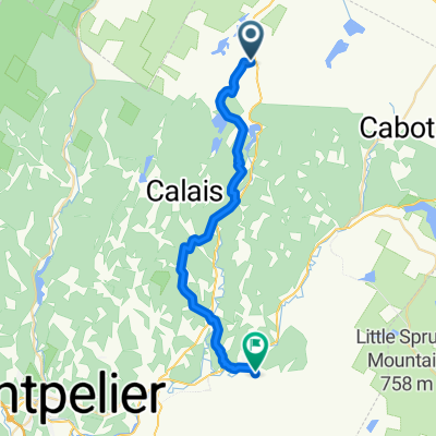 From Woodbury to Plainfield
- Distance
- 27.3 km
- Ascent
- 621 m
- Descent
- 711 m
- Location
- Hardwick, Vermont, United States of America
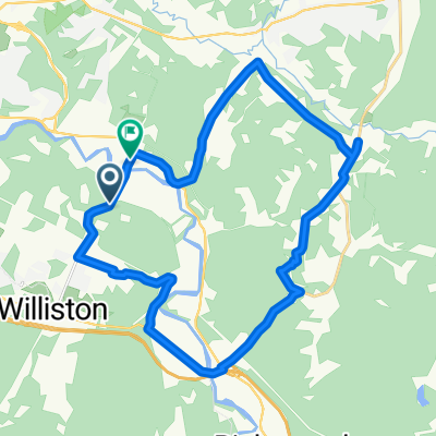 North Williston Road to River Road
- Distance
- 29.5 km
- Ascent
- 442 m
- Descent
- 498 m
- Location
- Williston, Vermont, United States of America
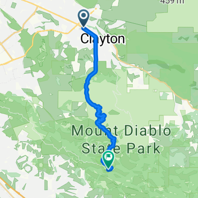 Clayton Rd, Clayton to S Gate Rd, Clayton
- Distance
- 17.4 km
- Ascent
- 1,005 m
- Descent
- 605 m
- Location
- Clayton, California, United States of America
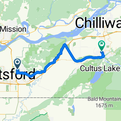 Picton Street to Cowichan Street
- Distance
- 34.6 km
- Ascent
- 458 m
- Descent
- 467 m
- Location
- Abbotsford, British Columbia, Canada
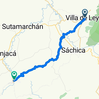 Calle 11, Villa de Leyva a Calle 5, Ráquira
- Distance
- 21.8 km
- Ascent
- 703 m
- Descent
- 682 m
- Location
- Villa de Leiva, Departamento de Boyacá, Colombia
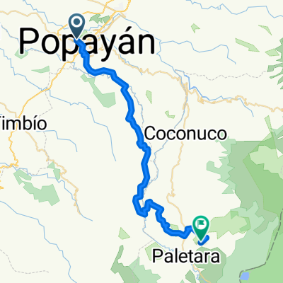 Ruta desde Carrera # 2-6
- Distance
- 53.1 km
- Ascent
- 2,678 m
- Descent
- 1,391 m
- Location
- Popayán, Departamento del Cauca, Colombia
 The Queenstown Trail - Queenstown Bay to Arrowtown
- Distance
- 32.8 km
- Ascent
- 609 m
- Descent
- 681 m
- Location
- Arrowtown, Otago, New Zealand
 82 Threepwood Rd, Queenstown to 82 Threepwood Rd, Queenstown
- Distance
- 33.8 km
- Ascent
- 535 m
- Descent
- 534 m
- Location
- Arrowtown, Otago, New Zealand
 Plenty Gorge MTB Norge Tour
- Distance
- 28.8 km
- Ascent
- 462 m
- Descent
- 462 m
- Location
- Plenty, Victoria, Australia
 e-MTB Adventure Ride. Ringwood, Warrandyte State Park, Lilydale.
- Distance
- 61.3 km
- Ascent
- 460 m
- Descent
- 486 m
- Location
- Ringwood East, Victoria, Australia
 逆風鐵馬團 - 多納林道之安通吊橋
- Distance
- 10.1 km
- Ascent
- 594 m
- Descent
- 594 m
 Xīnxiāng Road, Xinyi Township, Nantou County, Taiwan 556
- Distance
- 70 km
- Ascent
- 3,117 m
- Descent
- 1,191 m
- Location
- Lugu, Taiwan, Taiwan
 hjkj
hjkj- Distance
- 43.9 km
- Ascent
- 793 m
- Descent
- 2,680 m
- Location
- Nanche Bazar, Eastern Region, Nepal
 Jotiba 10K
- Distance
- 10.5 km
- Ascent
- 519 m
- Descent
- 121 m
- Location
- Kolhāpur, Maharashtra, India
 De Rust - Oudtshoorn
- Distance
- 71.8 km
- Ascent
- 550 m
- Descent
- 749 m
- Location
- De Rust, Province of the Western Cape, Republic of South Africa
 3-day plan Dag 3 wild
- Distance
- 59.9 km
- Ascent
- 611 m
- Descent
- 715 m
- Location
- Bredasdorp, Province of the Western Cape, Republic of South Africa
 Midweek ride to Thorpe
- Distance
- 60 km
- Ascent
- 890 m
- Descent
- 832 m
- Location
- Kingston, England, United Kingdom
 Dorking, Ranmore, Leatherhead
- Distance
- 34.4 km
- Ascent
- 543 m
- Descent
- 543 m
- Location
- Dorking, England, United Kingdom