For your trekking bike
Ride the best trekking routes worldwide
From riverside paths to cross-country trails—these long-distance routes are perfect for panniers, pit stops, and discovery.
 Brenner nach Garda
- Distance
- 242.1 km
- Ascent
- 2,280 m
- Descent
- 3,506 m
- Location
- Colle Isarco, Trentino-Alto Adige, Italy
 From Treviso to Innsbruck
- Distance
- 387.8 km
- Ascent
- 8,754 m
- Descent
- 8,188 m
- Location
- Treviso, Veneto, Italy
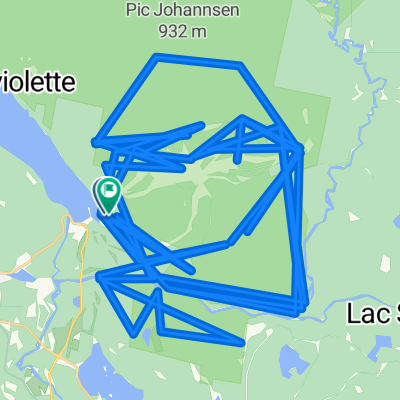 course
- Distance
- 201 km
- Ascent
- 7,289 m
- Descent
- 7,280 m
- Location
- Mont-Tremblant, Quebec, Canada
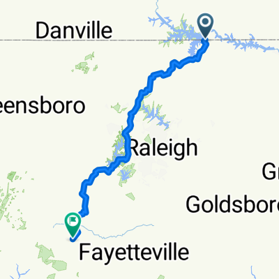 Drewry Virginia Line Rd, Norlina to Southern Pines
- Distance
- 260.1 km
- Ascent
- 1,883 m
- Descent
- 1,839 m
- Location
- Norlina, North Carolina, United States of America
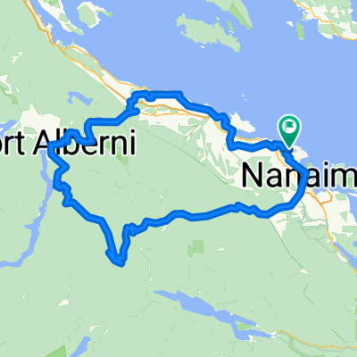 Hawk Point Rd, Nanaimo to Hawk Point Rd, Nanaimo
- Distance
- 231.6 km
- Ascent
- 5,655 m
- Descent
- 5,657 m
- Location
- Nanaimo, British Columbia, Canada
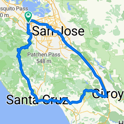 home to Santa Cruz to Gilroy to home
- Distance
- 200.7 km
- Ascent
- 3,507 m
- Descent
- 3,509 m
- Location
- Mountain View, California, United States
 Salesópolis à Aparecida 2012 000000- Pedal Serrano (Roteiro completo)
- Distance
- 227 km
- Ascent
- 1,272 m
- Descent
- 1,517 m
- Location
- Santa Branca, São Paulo, Brazil
 Serra do Corvo Branco e Rio do Rastro
- Distance
- 486.3 km
- Ascent
- 3,525 m
- Descent
- 3,532 m
- Location
- Blumenau, Santa Catarina, Brazil
 Whanganui-Wellington.230
- Distance
- 239.5 km
- Ascent
- 550 m
- Descent
- 552 m
- Location
- Wanganui, Manawatu-Wanganui, New Zealand
 NZ_ Gemütliche Route mach Picton
- Distance
- 428.4 km
- Ascent
- 4,051 m
- Descent
- 4,051 m
- Location
- Christchurch, Canterbury, New Zealand
 Strzelecki Wander
- Distance
- 235.4 km
- Ascent
- 1,759 m
- Descent
- 1,811 m
- Location
- Yallourn, Victoria, Australia
 Kangaroo Island
- Distance
- 377.8 km
- Ascent
- 2,087 m
- Descent
- 2,074 m
 一ツ木町8丁目, 刈谷市へ国道24号, 木津川市
- Distance
- 235.4 km
- Ascent
- 1,084 m
- Descent
- 1,070 m
- Location
- Chiryū, Aichi, Japan
![Ph0]에서 경로강천면 572-15](https://media.bikemap.net/routes/17305868/staticmaps/in_47aeaf06-2648-4b01-a003-ab0e11fee575_400x400_bikemap-2021-3D-static.png) Ph0]에서 경로강천면 572-15
Ph0]에서 경로강천면 572-15- Distance
- 296.7 km
- Ascent
- 3,909 m
- Descent
- 3,921 m
- Location
- Yeoju, Gyeonggi-do, Republic of Korea
 Nubra Vally Y fork.
- Distance
- 235.7 km
- Ascent
- 2,462 m
- Descent
- 2,671 m
- Location
- Leh, Kashmir, India
 Tour de Bengaluru
- Distance
- 490.7 km
- Ascent
- 1,078 m
- Descent
- 1,064 m
- Location
- Bengaluru, Karnataka, India
 Fast ride
- Distance
- 462.5 km
- Ascent
- 431 m
- Descent
- 379 m
 Eastern Cape 2
- Distance
- 323.8 km
- Ascent
- 4,685 m
- Descent
- 4,682 m
- Location
- Port Alfred, Eastern Cape, Republic of South Africa
 Burrell Road to Grafton House
- Distance
- 281.1 km
- Ascent
- 830 m
- Descent
- 834 m
- Location
- Ipswich, England, United Kingdom
 Burrell Road to Grafton House
- Distance
- 281.1 km
- Ascent
- 830 m
- Descent
- 834 m
- Location
- Ipswich, England, United Kingdom