For your trekking bike
Ride the best trekking routes worldwide
From riverside paths to cross-country trails—these long-distance routes are perfect for panniers, pit stops, and discovery.
 Gravel Austria, Etappe Salzburg
- Distance
- 257.6 km
- Ascent
- 5,510 m
- Descent
- 6,342 m
- Location
- Saalbach, Salzburg, Austria
 Gravel Austria, Etappe Tirol, Ost - West
- Distance
- 288.9 km
- Ascent
- 3,301 m
- Descent
- 2,747 m
- Location
- Hollersbach im Pinzgau, Salzburg, Austria
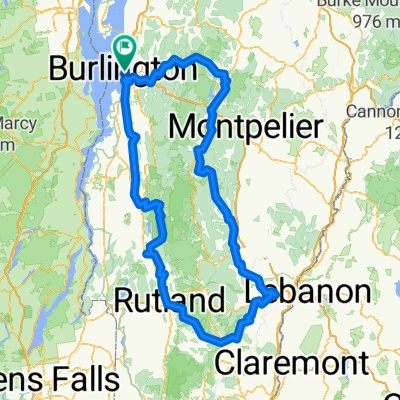 Harrington Terr, Burlington to Harrington Terr, Burlington
- Distance
- 421.9 km
- Ascent
- 8,455 m
- Descent
- 8,453 m
- Location
- Burlington, Vermont, United States of America
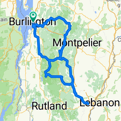 bike trip 1
- Distance
- 424.5 km
- Ascent
- 9,410 m
- Descent
- 9,408 m
- Location
- Burlington, Vermont, United States of America
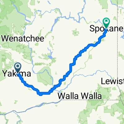
 From Yakima to Spokane
- Distance
- 445.6 km
- Ascent
- 3,278 m
- Descent
- 3,018 m
- Location
- Yakima, Washington, United States of America
 From Yakima to Spokane
- Distance
- 444.9 km
- Ascent
- 3,341 m
- Descent
- 3,079 m
- Location
- Terrace Heights, Washington, United States of America
 Sierra de la Ventana por FFCC vuelta Zanjón
- Distance
- 236.9 km
- Ascent
- 677 m
- Descent
- 677 m
- Location
- Bahía Blanca, Buenos Aires, Argentina
 Saltos del Moconá atajo selva
- Distance
- 298.1 km
- Ascent
- 1,500 m
- Descent
- 1,516 m
- Location
- Apóstoles, Misiones Province, Argentina
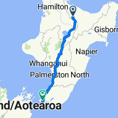 Entspannende Route in Wellington
- Distance
- 471.8 km
- Ascent
- 3,301 m
- Descent
- 3,575 m
- Location
- Rotorua, Bay of Plenty Region, New Zealand
 Wanganui - Taupo by 2FTP
- Distance
- 365 km
- Ascent
- 2,356 m
- Descent
- 1,994 m
- Location
- Wanganui, Manawatu-Wanganui, New Zealand
 Peaks Challenge Falls Creek
- Distance
- 235 km
- Ascent
- 3,161 m
- Descent
- 3,158 m
- Location
- Mount Beauty, Victoria, Australia
 Crowsnest Blackbutt day Ride
- Distance
- 369.3 km
- Ascent
- 2,031 m
- Descent
- 2,056 m
- Location
- Samford Valley, Queensland, Australia
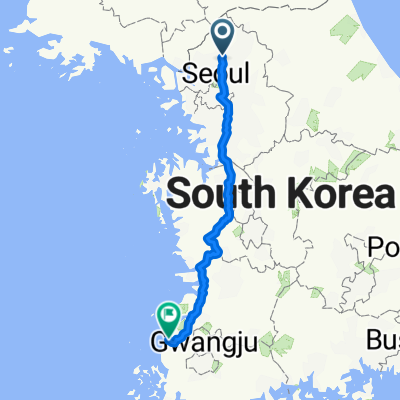 영광 배낭여행
- Distance
- 406.1 km
- Ascent
- 2,659 m
- Descent
- 2,709 m
- Location
- Yangju, Gyeonggi-do, Republic of Korea
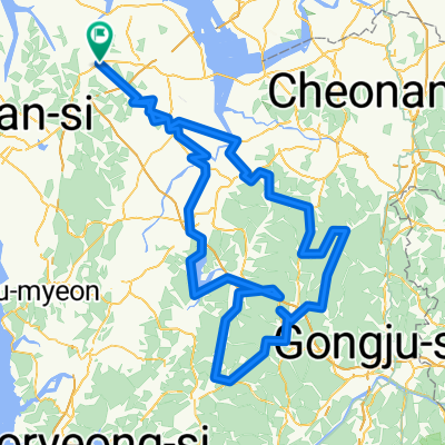 마곡사 155km
- Distance
- 236.9 km
- Ascent
- 4,071 m
- Descent
- 4,058 m
- Location
- Tangjin, Chungcheongnam-do, Republic of Korea
 Tour de Bengaluru
- Distance
- 490.7 km
- Ascent
- 1,078 m
- Descent
- 1,064 m
- Location
- Bengaluru, Karnataka, India
 Nubra Vally Y fork.
- Distance
- 235.7 km
- Ascent
- 2,462 m
- Descent
- 2,671 m
- Location
- Leh, Kashmir, India
 Home to Bojaan's
- Distance
- 279.5 km
- Ascent
- 2,156 m
- Descent
- 2,245 m
 Salaama Road 715a, Kampala to Iganga
- Distance
- 275.3 km
- Ascent
- 3,210 m
- Descent
- 3,206 m
- Location
- Kampala, Central Region, Uganda
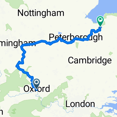 From Oxford to Coventry
- Distance
- 352.5 km
- Ascent
- 1,914 m
- Descent
- 1,983 m
- Location
- Oxford, England, United Kingdom
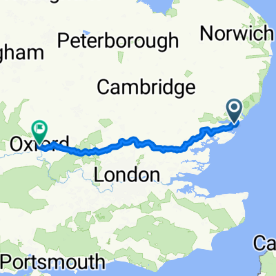 From Harwich to Cheltenham
- Distance
- 255.9 km
- Ascent
- 1,491 m
- Descent
- 1,424 m
- Location
- Dovercourt, England, United Kingdom