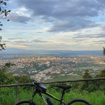
Cycling in Chiang Mai
Discover a map of 815 cycling routes and bike trails near Chiang Mai, created by our community.
Region portrait
Get to know Chiang Mai
Find the right bike route for you through Chiang Mai, where we've got 815 cycle routes to explore. Most people get on their bikes to ride here in the months of January and December.
120,993 km
Tracked distance
815
Cycle routes
200,952
Population
Community
Most active users in Chiang Mai
Handpicked routes
Discover Chiang Mai through these collections
Tour
Tour
From our community
The best bike routes in and around Chiang Mai
Chiang Mai
Cycling route in Chiang Mai, Chiang Mai, Thailand
- 669.4 km
- Distance
- 1,461 m
- Ascent
- 1,461 m
- Descent
DoiSuthep
Cycling route in Chiang Mai, Chiang Mai, Thailand
- 49.9 km
- Distance
- 1,107 m
- Ascent
- 1,109 m
- Descent
MHS Loop
Cycling route in Chiang Mai, Chiang Mai, Thailand
- 533.7 km
- Distance
- 5,294 m
- Ascent
- 5,289 m
- Descent
Phuping Palace
Cycling route in Chiang Mai, Chiang Mai, Thailand
- 52.2 km
- Distance
- 1,083 m
- Ascent
- 1,098 m
- Descent
Discover more routes
 Reverse Samoeng Loop back via Bhubbing Palace
- Distance
- 116.8 km
- Ascent
- 2,847 m
- Descent
- 2,847 m
- Location
- Chiang Mai, Chiang Mai, Thailand
 MTCM - ITT Huay Tung Thao Lake
- Distance
- 8.3 km
- Ascent
- 72 m
- Descent
- 78 m
- Location
- Chiang Mai, Chiang Mai, Thailand
 CPB small circle
- Distance
- 13.7 km
- Ascent
- 73 m
- Descent
- 71 m
- Location
- Chiang Mai, Chiang Mai, Thailand
 Chiangmai U to Doi Su Thep view point
- Distance
- 18.1 km
- Ascent
- 404 m
- Descent
- 403 m
- Location
- Chiang Mai, Chiang Mai, Thailand
 Cycle in Thai 03 : Chiang Rai, Myanmar
- Distance
- 263.6 km
- Ascent
- 781 m
- Descent
- 703 m
- Location
- Chiang Mai, Chiang Mai, Thailand
 Moderate Route in Chiang Mai
- Distance
- 7.4 km
- Ascent
- 21 m
- Descent
- 18 m
- Location
- Chiang Mai, Chiang Mai, Thailand
 straight to samoeng
- Distance
- 41.2 km
- Ascent
- 1,028 m
- Descent
- 849 m
- Location
- Chiang Mai, Chiang Mai, Thailand
 Chiang Mai - Rim Ping
- Distance
- 65 km
- Ascent
- 30 m
- Descent
- 29 m
- Location
- Chiang Mai, Chiang Mai, Thailand


