
Cycling in Bang Bua Thong
Discover a map of 36 cycling routes and bike trails near Bang Bua Thong, created by our community.
Region portrait
Get to know Bang Bua Thong
Find the right bike route for you through Bang Bua Thong, where we've got 36 cycle routes to explore. Most people get on their bikes to ride here in the month of January.
1,612 km
Tracked distance
36
Cycle routes
41,567
Population
Community
Most active users in Bang Bua Thong


From our community
The best bike routes in and around Bang Bua Thong

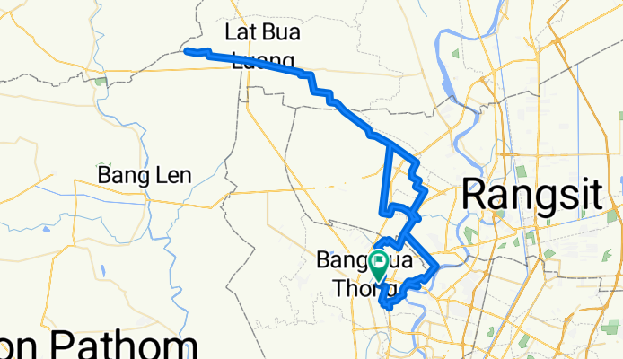
BikeLane-WatTonChuek-Horse'NCoffee-K9
Cycling route in Bang Bua Thong, Nonthaburi, Thailand
- 58.1 km
- Distance
- 8 m
- Ascent
- 12 m
- Descent
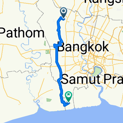
MyMapCycling
Cycling route in Bang Bua Thong, Nonthaburi, Thailand
- 127.6 km
- Distance
- 8 m
- Ascent
- 8 m
- Descent

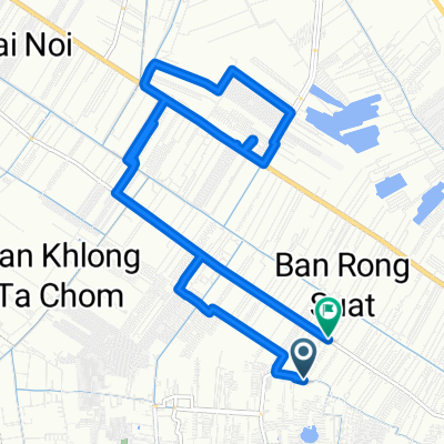
Mini Audec 2019
Cycling route in Bang Bua Thong, Nonthaburi, Thailand
- 45.1 km
- Distance
- 17 m
- Ascent
- 24 m
- Descent

Discover more routes
 ถนน บางกรวย - ไทรน้อย 59, ตำบลโสนลอย to ถนน บางศรีเมือง 50/66
- Distance
- 17.6 km
- Ascent
- 42 m
- Descent
- 41 m
- Location
- Bang Bua Thong, Nonthaburi, Thailand
 My_route1
- Distance
- 18.8 km
- Ascent
- 16 m
- Descent
- 17 m
- Location
- Bang Bua Thong, Nonthaburi, Thailand
 บางขุนเทียนขาไป
- Distance
- 63.9 km
- Ascent
- 28 m
- Descent
- 33 m
- Location
- Bang Bua Thong, Nonthaburi, Thailand
 Quick bike tour from (null) to (null)
- Distance
- 8.7 km
- Ascent
- 9 m
- Descent
- 8 m
- Location
- Bang Bua Thong, Nonthaburi, Thailand
 ประเทศไทย, ตำบล ละหาร to ตำบล บึงบอน
- Distance
- 50.7 km
- Ascent
- 258 m
- Descent
- 260 m
- Location
- Bang Bua Thong, Nonthaburi, Thailand
 ซอย หมู่บ้านบัวทองแลนด์ ซอย 3/10 89/32, ตำบล บางบัวทอง to ซอย หมู่บ้านบัวทองแลนด์ ซอย 3/10 89/32, ตำบล บางบัวทอง
- Distance
- 0.1 km
- Ascent
- 0 m
- Descent
- 29 m
- Location
- Bang Bua Thong, Nonthaburi, Thailand
 ตำบล พิมลราช to ตำบล พิมลราช
- Distance
- 18.3 km
- Ascent
- 23 m
- Descent
- 22 m
- Location
- Bang Bua Thong, Nonthaburi, Thailand
 Recovered Route
- Distance
- 13.8 km
- Ascent
- 3 m
- Descent
- 7 m
- Location
- Bang Bua Thong, Nonthaburi, Thailand