
Cycling in Yangp'yŏng
Discover a map of 164 cycling routes and bike trails near Yangp'yŏng, created by our community.
Region portrait
Get to know Yangp'yŏng
Find the right bike route for you through Yangp'yŏng, where we've got 164 cycle routes to explore. Most people get on their bikes to ride here in the months of June and October.
8,913 km
Tracked distance
164
Cycle routes
83,367
Population
Community
Most active users in Yangp'yŏng


From our community
The best bike routes in and around Yangp'yŏng


양평읍 538-1 ~ 문막읍
Cycling route in Yangp'yŏng, Gyeonggi-do, South Korea
- 101.2 km
- Distance
- 477 m
- Ascent
- 409 m
- Descent


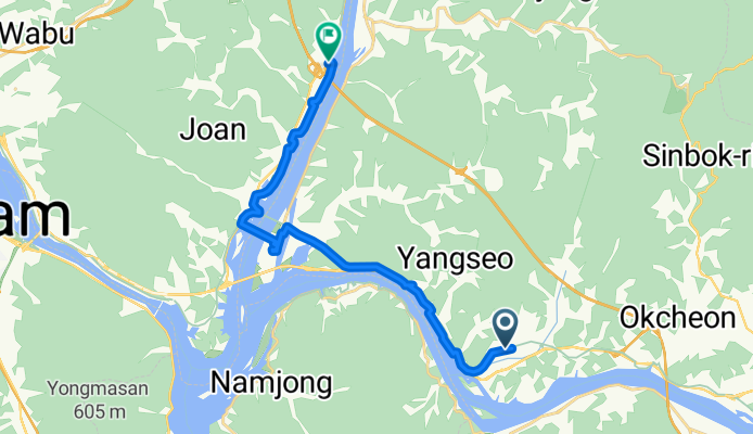
양서면 496-8 ~ 조안면 285-6
Cycling route in Yangp'yŏng, Gyeonggi-do, South Korea
- 20.4 km
- Distance
- 162 m
- Ascent
- 187 m
- Descent
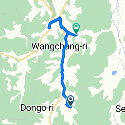
여양로, 여주시에서 왕대리, 여주시까지
Cycling route in Yangp'yŏng, Gyeonggi-do, South Korea
- 13.5 km
- Distance
- 39 m
- Ascent
- 32 m
- Descent

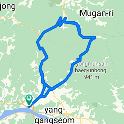
양평군에서 양평군까지
Cycling route in Yangp'yŏng, Gyeonggi-do, South Korea
- 30.4 km
- Distance
- 342 m
- Ascent
- 345 m
- Descent
Discover more routes
 대신면, 여주시에서 천서리, 여주시까지
- Distance
- 63.3 km
- Ascent
- 300 m
- Descent
- 298 m
- Location
- Yangp'yŏng, Gyeonggi-do, South Korea
 Day#1
Day#1- Distance
- 77.2 km
- Ascent
- 938 m
- Descent
- 977 m
- Location
- Yangp'yŏng, Gyeonggi-do, South Korea
 JeePyeong - 88km
- Distance
- 88.5 km
- Ascent
- 849 m
- Descent
- 850 m
- Location
- Yangp'yŏng, Gyeonggi-do, South Korea
 Day#2
Day#2- Distance
- 61.5 km
- Ascent
- 703 m
- Descent
- 710 m
- Location
- Yangp'yŏng, Gyeonggi-do, South Korea
 대곡치이사미
- Distance
- 117.5 km
- Ascent
- 1,320 m
- Descent
- 1,320 m
- Location
- Yangp'yŏng, Gyeonggi-do, South Korea
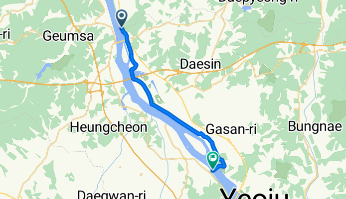
 Yangp'yŏng - Yeoju
- Distance
- 25.7 km
- Ascent
- 170 m
- Descent
- 158 m
- Location
- Yangp'yŏng, Gyeonggi-do, South Korea
 양평군에서 양평군까지
- Distance
- 5.5 km
- Ascent
- 21 m
- Descent
- 74 m
- Location
- Yangp'yŏng, Gyeonggi-do, South Korea
 asin-seoljimae-yumyeong loop
- Distance
- 63.7 km
- Ascent
- 1,885 m
- Descent
- 1,890 m
- Location
- Yangp'yŏng, Gyeonggi-do, South Korea