
Cycling in T’aebaek
Discover a map of 35 cycling routes and bike trails near T’aebaek, created by our community.
Region portrait
Get to know T’aebaek
Find the right bike route for you through T’aebaek, where we've got 35 cycle routes to explore.
1,865 km
Tracked distance
35
Cycle routes
48,962
Population
Community
Most active users in T’aebaek


From our community
The best bike routes in and around T’aebaek


정선군에서 정선군까지
Cycling route in T’aebaek, Gangwon-do, South Korea
- 64 km
- Distance
- 1,985 m
- Ascent
- 1,989 m
- Descent


서학로, 태백시 to 사북읍 산153-18, 정선군
Cycling route in T’aebaek, Gangwon-do, South Korea
- 81.1 km
- Distance
- 966 m
- Ascent
- 1,366 m
- Descent


삼수동 강원도, 태백시 to 서학로, 태백시
Cycling route in T’aebaek, Gangwon-do, South Korea
- 45.9 km
- Distance
- 1,543 m
- Ascent
- 1,205 m
- Descent
![고한읍Ph0]으로 라우팅](https://media.bikemap.net/routes/17602943/staticmaps/in_5ec2fe13-4cce-4f78-9a40-8c23240e76c8_694x400_bikemap-2021-3D-static.png)
Discover more routes
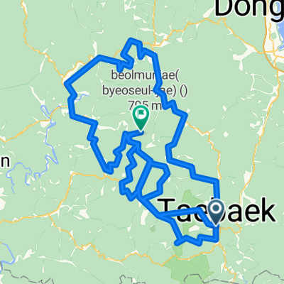
 태백제2코스(함백산힐클라임코스)
- Distance
- 14.1 km
- Ascent
- 745 m
- Descent
- 146 m
- Location
- T’aebaek, Gangwon-do, South Korea
 점심 라이딩
- Distance
- 58.1 km
- Ascent
- 1,529 m
- Descent
- 1,526 m
- Location
- T’aebaek, Gangwon-do, South Korea
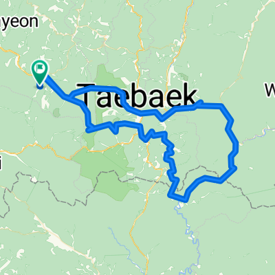 강원랜드-두문동재-석개재-만항재-강원랜드
- Distance
- 118.3 km
- Ascent
- 2,676 m
- Descent
- 2,639 m
- Location
- T’aebaek, Gangwon-do, South Korea
 PT64_Taebaek
- Distance
- 214.9 km
- Ascent
- 11,446 m
- Descent
- 11,567 m
- Location
- T’aebaek, Gangwon-do, South Korea
 고한_별마로
- Distance
- 98.7 km
- Ascent
- 1,289 m
- Descent
- 1,724 m
- Location
- T’aebaek, Gangwon-do, South Korea
 운탄고도태백
- Distance
- 91.2 km
- Ascent
- 3,010 m
- Descent
- 3,010 m
- Location
- T’aebaek, Gangwon-do, South Korea
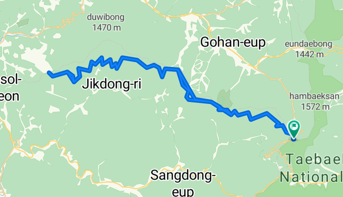
 영월 직동리
- Distance
- 16.6 km
- Ascent
- 155 m
- Descent
- 514 m
- Location
- T’aebaek, Gangwon-do, South Korea
 중동면-만항재
- Distance
- 59.9 km
- Ascent
- 824 m
- Descent
- 1,422 m
- Location
- T’aebaek, Gangwon-do, South Korea