![취암동 516-31Ph0]으로 라우팅](https://media.bikemap.net/routes/17827865/staticmaps/in_2ef407d6-1c91-4f11-a363-c1a829b055a4_694x400_bikemap-2021-3D-static.png)
![Ph0]에서 경로취암동 516-32](https://media.bikemap.net/routes/17681530/staticmaps/in_445fd246-808b-48d0-a9f9-adad56b982c3_694x400_bikemap-2021-3D-static.png)
![취암동 516-31Ph0]으로 라우팅](https://media.bikemap.net/routes/17617764/staticmaps/in_b29cd215-4284-4e50-9f8f-0f2a90126d0e_694x400_bikemap-2021-3D-static.png)
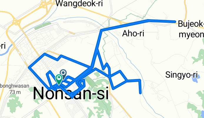
채운면 ~ 취암동 516-31
- 43.2 km
- 401 m
- 435 m
- Nonsan, Chungcheongnam-do, South Korea

Find the right bike route for you through Nonsan, where we've got 102 cycle routes to explore. Most people get on their bikes to ride here in the months of July and August.
Tracked distance
Cycle routes
Population
![취암동 516-31Ph0]으로 라우팅](https://media.bikemap.net/routes/17827865/gallery/thumbs/bb359bc9-960f-4ab6-b4a9-be0c39c5d654.jpg.0x384_q80.jpg)
![취암동 516-31Ph0]으로 라우팅](https://media.bikemap.net/routes/17827865/gallery/thumbs/32c81cdb-4416-4fd9-a179-7969b1099ee3.jpg.0x384_q80.jpg)
![취암동 516-31Ph0]으로 라우팅](https://media.bikemap.net/routes/17827865/gallery/thumbs/0c3bd041-3be5-4a63-bf4c-5a7df85d8503.jpg.0x384_q80.jpg)
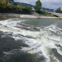
Cycling route in Nonsan, Chungcheongnam-do, South Korea
![Ph0]에서 경로취암동 516-32](https://media.bikemap.net/routes/17681530/gallery/thumbs/0160aa2d-a3d7-4b96-b048-d437fc43acef.jpg.0x384_q80.jpg)
![Ph0]에서 경로취암동 516-32](https://media.bikemap.net/routes/17681530/gallery/thumbs/54694803-2167-408a-ac55-4484c3bd337c.jpg.0x384_q80.jpg)
Cycling route in Nonsan, Chungcheongnam-do, South Korea


![취암동 516-31Ph0]으로 라우팅](https://media.bikemap.net/routes/17617764/gallery/thumbs/63513a16-48a9-44d8-90f4-05d7a4291892.jpg.0x384_q80.jpg)
![취암동 516-31Ph0]으로 라우팅](https://media.bikemap.net/routes/17617764/gallery/thumbs/3977496c-6c54-4b64-b585-f09ff15dcba5.jpg.0x384_q80.jpg)
![취암동 516-31Ph0]으로 라우팅](https://media.bikemap.net/routes/17617764/gallery/thumbs/5151205c-8c9a-4651-96a8-98ecf01c007b.jpg.0x384_q80.jpg)
Cycling route in Nonsan, Chungcheongnam-do, South Korea
![취암동 516-31Ph0]으로 라우팅](https://media.bikemap.net/routes/17390107/gallery/thumbs/38334292-e470-4f49-887b-6601e49e9d26.jpg.208x208_q80_crop.jpg)