Cycling in Hughesdale
Discover a map of 100 cycling routes and bike trails near Hughesdale, created by our community.
Region portrait
Get to know Hughesdale
Find the right bike route for you through Hughesdale, where we've got 100 cycle routes to explore. Most people get on their bikes to ride here in the months of October and December.
3,465 km
Tracked distance
100
Cycle routes
7,055
Population
Community
Most active users in Hughesdale
From our community
The best bike routes in and around Hughesdale
Oakleigh to South Yarra via Convent & parkville
Cycling route in Hughesdale, Victoria, Australia
Oakleigh to South Yarra via convent & parkville, return by train
- 38 km
- Distance
- 80 m
- Ascent
- 132 m
- Descent
16 Westminster Street, Oakleigh to 1 Heath Avenue, Oakleigh
Cycling route in Hughesdale, Victoria, Australia
- 5.2 km
- Distance
- 27 m
- Ascent
- 23 m
- Descent
Hughesdale to Caulfield loop 50 km
Cycling route in Hughesdale, Victoria, Australia
Hughesdale Station to Jells Park, Dandenong Creek trail and Skyrail and Caulfield Station
- 49.9 km
- Distance
- 270 m
- Ascent
- 269 m
- Descent
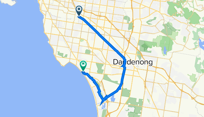
Hughesdale to Mordialloc
Cycling route in Hughesdale, Victoria, Australia
This follows the Djerring Trail and connects to the southern part of the Dandenong Creek Trail
- 35.9 km
- Distance
- 49 m
- Ascent
- 92 m
- Descent
Discover more routes
 Oakliegh to Spencer st via Convent
- Distance
- 31.5 km
- Ascent
- 94 m
- Descent
- 147 m
- Location
- Hughesdale, Victoria, Australia
 Hughsedale to Spencer St Via Deepdene
- Distance
- 34.6 km
- Ascent
- 172 m
- Descent
- 217 m
- Location
- Hughesdale, Victoria, Australia
 Hughesdale to Red Hill
- Distance
- 64.2 km
- Ascent
- 415 m
- Descent
- 276 m
- Location
- Hughesdale, Victoria, Australia
 Hughsedale to Spencer St
- Distance
- 31.1 km
- Ascent
- 120 m
- Descent
- 166 m
- Location
- Hughesdale, Victoria, Australia
 Scotchmans Creek Trl, Oakleigh to Oakleigh Ward, Oakleigh
- Distance
- 54.3 km
- Ascent
- 0 m
- Descent
- 0 m
- Location
- Hughesdale, Victoria, Australia
 Oakliegh to Yan Yean Lake
- Distance
- 55.2 km
- Ascent
- 500 m
- Descent
- 497 m
- Location
- Hughesdale, Victoria, Australia
 Epic Bike
- Distance
- 87.8 km
- Ascent
- 658 m
- Descent
- 659 m
- Location
- Hughesdale, Victoria, Australia
 hughesdale to convent via blackburn lake
- Distance
- 40.4 km
- Ascent
- 178 m
- Descent
- 211 m
- Location
- Hughesdale, Victoria, Australia


