
Cycling in Glenorie
Discover a map of 7 cycling routes and bike trails near Glenorie, created by our community.
Region portrait
Get to know Glenorie
Find the right bike route for you through Glenorie, where we've got 7 cycle routes to explore.
402 km
Tracked distance
7
Cycle routes
3,360
Population
Community
Most active users in Glenorie

From our community
The best bike routes in and around Glenorie
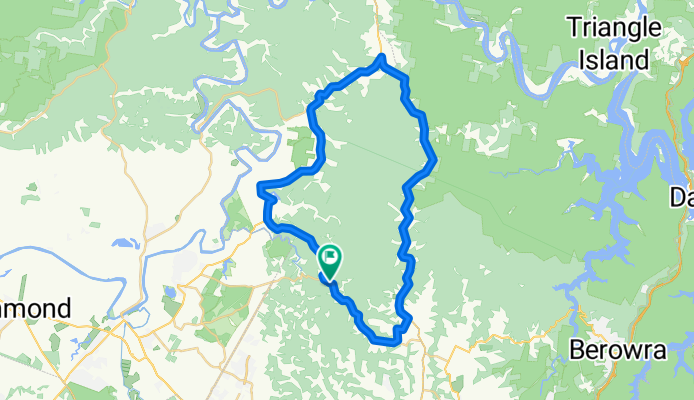
Glenorie-rural ride
Cycling route in Glenorie, New South Wales, Australia
This route is one of about 50 k. It is best done in the morning when the traffic is headed in the opposite direction. It is a good ride with a number of hilly sections. Follow cattai ridge road and turn off at Post Office road to avoid the hair pin turns before Old Northern road.Follow Old Northe
- 51.7 km
- Distance
- 385 m
- Ascent
- 428 m
- Descent
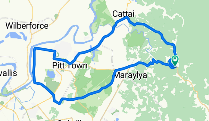
Cattai ridge ride
Cycling route in Glenorie, New South Wales, Australia
Start at the corner of Cattai ridge and Halcrow road, go down to the end of Halcrow road and turn left into Wisemans ferry road. Continue until Bootles lane turn right follow the road and turn right into bathurst road and then Pitt town bottoms road. continue until you cross Pitt town road and i
- 33.4 km
- Distance
- 218 m
- Ascent
- 218 m
- Descent
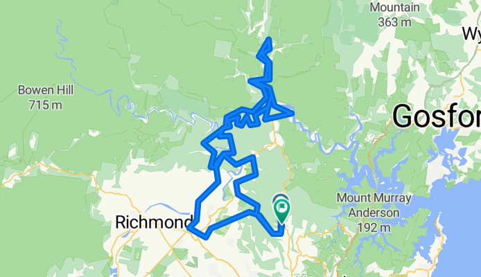
Tar 'n' Dirt
Cycling route in Glenorie, New South Wales, Australia
- 197.3 km
- Distance
- 1,009 m
- Ascent
- 1,002 m
- Descent
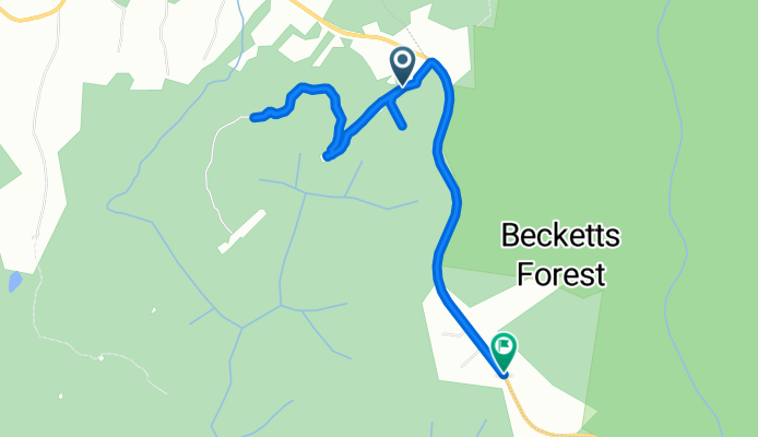
maroota tracks
Cycling route in Glenorie, New South Wales, Australia
- 5.9 km
- Distance
- 113 m
- Ascent
- 94 m
- Descent