
Cycling in Alcoutim
Discover a map of 46 cycling routes and bike trails near Alcoutim, created by our community.
Region portrait
Get to know Alcoutim
Find the right bike route for you through Alcoutim, where we've got 46 cycle routes to explore.
3,970 km
Tracked distance
46
Cycle routes
Community
Most active users in Alcoutim


Handpicked routes
Discover Alcoutim through these collections

From our community
The best bike routes in and around Alcoutim

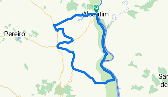
Alcoutim Touring Tour
Cycling route in Alcoutim, Faro District, Portugal
- 36.4 km
- Distance
- 654 m
- Ascent
- 648 m
- Descent

Algarviana1 Alcautim - Vaqueiros
Cycling route in Alcoutim, Faro District, Portugal
- 40 km
- Distance
- 573 m
- Ascent
- 373 m
- Descent

Southern Portugal, from Faro to Faro via Aymento, Mertola, Beja, Evora, Lisabon, Sines, Lagos, Albufera
Cycling route in Alcoutim, Faro District, Portugal
- 921.8 km
- Distance
- 1,251 m
- Ascent
- 1,254 m
- Descent
Sustentur Alcoutim Tour
Cycling route in Alcoutim, Faro District, Portugal
- 36.2 km
- Distance
- 654 m
- Ascent
- 648 m
- Descent
Discover more routes
 Almodovar 3. Etappe
- Distance
- 65.2 km
- Ascent
- 507 m
- Descent
- 242 m
- Location
- Alcoutim, Faro District, Portugal
 P 001: Alcoutim
- Distance
- 83.4 km
- Ascent
- 794 m
- Descent
- 794 m
- Location
- Alcoutim, Faro District, Portugal
 Troféu Alpendre Internacional do Guadiana 2015 (2ª etapa)
- Distance
- 161 km
- Ascent
- 1,011 m
- Descent
- 1,085 m
- Location
- Alcoutim, Faro District, Portugal
 GR114 Sanlúcar de Guadiana
- Distance
- 18.9 km
- Ascent
- 324 m
- Descent
- 311 m
- Location
- Alcoutim, Faro District, Portugal
 Day 1.1 - S1 Alcoutim - Balurcos
- Distance
- 23.3 km
- Ascent
- 557 m
- Descent
- 376 m
- Location
- Alcoutim, Faro District, Portugal
 Day 1.2 - S2 Balurcos - Furnazinhas
- Distance
- 14.1 km
- Ascent
- 300 m
- Descent
- 326 m
- Location
- Alcoutim, Faro District, Portugal
 TRACK 003
- Distance
- 42.7 km
- Ascent
- 415 m
- Descent
- 415 m
- Location
- Alcoutim, Faro District, Portugal
 1- Alcoutim 66Km 740m
- Distance
- 66.5 km
- Ascent
- 555 m
- Descent
- 554 m
- Location
- Alcoutim, Faro District, Portugal