
Cycling in Freila
Discover a map of 9 cycling routes and bike trails near Freila, created by our community.
Region portrait
Get to know Freila
Find the right bike route for you through Freila, where we've got 9 cycle routes to explore.
655 km
Tracked distance
9
Cycle routes
1,051
Population


From our community
The best bike routes in and around Freila

A92N-Forest Narvael-Charches
Cycling route in Freila, Andalusia, Spain
Salimos desde la A92N en salida 28 dirección cortijo de Narváez, cruzamos la sierra de Baza en busca de Charches.
- 43.4 km
- Distance
- 1,147 m
- Ascent
- 910 m
- Descent

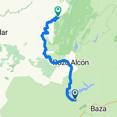
bacor olivar - pantano la bolera -freila - bacor
Cycling route in Freila, Andalusia, Spain
INICIAMOS LA RUTA CON UN DESCENSO, PARA EMPEZAR A SUBIR DIRECCION CUEVAS DEL CAMPO, SE HACE DURO YA QUE AUN TE PILLA EN FRIO, TOMAMOS DIRECCION POZO ALCON CON UN FALSO LLANO PICANDO HACIA ARRIBA Y CON ALGUNOS REPECHILLOS, LLEGAMOS AL EMBALSE DE LA BOLERA, ES SITIO ES INCREIBLE, VOLVEMOS POR DOND
- 77 km
- Distance
- 875 m
- Ascent
- 875 m
- Descent

Hiszpania 5
Cycling route in Freila, Andalusia, Spain
Zona de Acampada Controlada La Huerta Vieja
juntadeandalucia.es
- 105.9 km
- Distance
- 1,416 m
- Ascent
- 1,400 m
- Descent

los chaparros-quesada por tiscar-los chaparros
Cycling route in Freila, Andalusia, Spain
- 109.6 km
- Distance
- 2,312 m
- Ascent
- 2,335 m
- Descent
Discover more routes
 2007-08-03 Baza
- Distance
- 110.3 km
- Ascent
- 1,487 m
- Descent
- 1,486 m
- Location
- Freila, Andalusia, Spain
 GR7100B
- Distance
- 2.5 km
- Ascent
- 17 m
- Descent
- 78 m
- Location
- Freila, Andalusia, Spain
 segunda etapa
- Distance
- 78.6 km
- Ascent
- 1,190 m
- Descent
- 1,130 m
- Location
- Freila, Andalusia, Spain
 A92N-A92 por Centro visitantes y Charches
- Distance
- 51.3 km
- Ascent
- 1,099 m
- Descent
- 1,147 m
- Location
- Freila, Andalusia, Spain
 Freila-Cazorla
- Distance
- 76.9 km
- Ascent
- 1,081 m
- Descent
- 1,165 m
- Location
- Freila, Andalusia, Spain