
Cycling in Snetterton
Discover a map of 15 cycling routes and bike trails near Snetterton, created by our community.
Region portrait
Get to know Snetterton
Find the right bike route for you through Snetterton, where we've got 15 cycle routes to explore.
512 km
Tracked distance
15
Cycle routes
Community
Most active users in Snetterton


From our community
The best bike routes in and around Snetterton

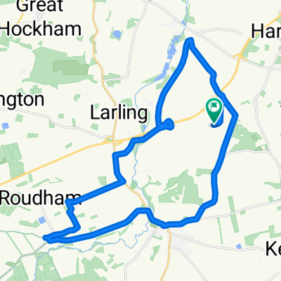
Café Cadence to Norwich via Wymondham quieter
Cycling route in Snetterton, England, United Kingdom
A quiet, reasonably diirect, route.
This was recorded in 2017. Now you can ride past the Hospital to the new link road to the multistory NRP carpark, instead of the open carpark/Covid test site.
- 36.2 km
- Distance
- 136 m
- Ascent
- 146 m
- Descent

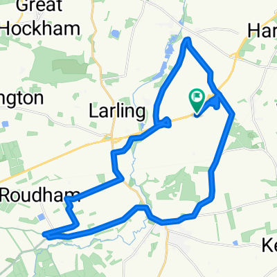
Café Cadence via Hapton to Rose Tavern
Cycling route in Snetterton, England, United Kingdom
A very quiet route (crosses A11 by light controlled crossing).
- 32.4 km
- Distance
- 168 m
- Ascent
- 175 m
- Descent

Stow Bedon 50m
Cycling route in Snetterton, England, United Kingdom
Based on Illington 50m ride
- 80.5 km
- Distance
- 176 m
- Ascent
- 176 m
- Descent

Illington loop
Cycling route in Snetterton, England, United Kingdom
- 80.4 km
- Distance
- 218 m
- Ascent
- 218 m
- Descent
Discover more routes
 Snetterton Race Track
- Distance
- 7 km
- Ascent
- 8 m
- Descent
- 5 m
- Location
- Snetterton, England, United Kingdom
 Angel inn
- Distance
- 23.3 km
- Ascent
- 72 m
- Descent
- 70 m
- Location
- Snetterton, England, United Kingdom
 Harling Road to Harling Road Snetterton
- Distance
- 24.5 km
- Ascent
- 71 m
- Descent
- 70 m
- Location
- Snetterton, England, United Kingdom
 HP200_2
- Distance
- 106.4 km
- Ascent
- 298 m
- Descent
- 285 m
- Location
- Snetterton, England, United Kingdom
 Sallow Lane, Larling, Norwich to South Lopham, Breckland
- Distance
- 17.9 km
- Ascent
- 88 m
- Descent
- 83 m
- Location
- Snetterton, England, United Kingdom
 Sallow Lane, Larling, Norwich to Lynford, Brandon
- Distance
- 22 km
- Ascent
- 85 m
- Descent
- 101 m
- Location
- Snetterton, England, United Kingdom
 old buck to Stowe bedon
- Distance
- 16.5 km
- Ascent
- 65 m
- Descent
- 79 m
- Location
- Snetterton, England, United Kingdom
 Old Buckenham, Attleborough to Bressingham Steam & Gardens, Diss Road, Diss
- Distance
- 13.6 km
- Ascent
- 28 m
- Descent
- 45 m
- Location
- Snetterton, England, United Kingdom