
Cycling in Chapel en le Frith
Discover a map of 32 cycling routes and bike trails near Chapel en le Frith, created by our community.
Region portrait
Get to know Chapel en le Frith
Find the right bike route for you through Chapel en le Frith, where we've got 32 cycle routes to explore.
1,944 km
Tracked distance
32
Cycle routes
6,728
Population
Community
Most active users in Chapel en le Frith


From our community
The best bike routes in and around Chapel en le Frith

Peaks 92km round route
Cycling route in Chapel en le Frith, England, United Kingdom
Chapel en le Frith - via
Chinley
Whaley Bridge
Macclesfield
Cat and Fiddle
Buxton
Bakewell
Baslow
Claver
Chapel en le Frith
- 92.5 km
- Distance
- 1,047 m
- Ascent
- 1,047 m
- Descent

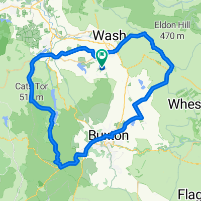
High Moors and Gritstone Tors
Cycling route in Chapel en le Frith, England, United Kingdom
- 45.1 km
- Distance
- 786 m
- Ascent
- 787 m
- Descent

Combs Head near Chapel-en-le-Frith
Cycling route in Chapel en le Frith, England, United Kingdom
Hidden away in Combs Valley and returns you to Whalley Bridge. It ramps up to 20% early on but never really eases off until the top.
- 1.1 km
- Distance
- 110 m
- Ascent
- 0 m
- Descent

Tour of the Peak, 24 Oct 2009
Cycling route in Chapel en le Frith, England, United Kingdom
Includes Pym's Chair, Cat & Fiddle, Winnat's Pass, The Strines and Holme Moss.
- 156.5 km
- Distance
- 1,798 m
- Ascent
- 1,798 m
- Descent
Discover more routes
 Tour of the Peak, 30 Oct 2010
- Distance
- 156.1 km
- Ascent
- 1,605 m
- Descent
- 1,605 m
- Location
- Chapel en le Frith, England, United Kingdom
 Chapel en le Frith 90km loop
- Distance
- 90.4 km
- Ascent
- 932 m
- Descent
- 943 m
- Location
- Chapel en le Frith, England, United Kingdom
 Keeper’s Cottage Loop
- Distance
- 29.4 km
- Ascent
- 622 m
- Descent
- 620 m
- Location
- Chapel en le Frith, England, United Kingdom
 peak district dams
- Distance
- 62.9 km
- Ascent
- 773 m
- Descent
- 782 m
- Location
- Chapel en le Frith, England, United Kingdom
 hathersage without monsal trail
- Distance
- 68.6 km
- Ascent
- 1,230 m
- Descent
- 1,231 m
- Location
- Chapel en le Frith, England, United Kingdom
- Mam Tor - Snake Pass - Holme Moss
- Distance
- 107.6 km
- Ascent
- ---
- Descent
- ---
- Location
- Chapel en le Frith, England, United Kingdom
 Peak Prep
- Distance
- 72.8 km
- Ascent
- 1,067 m
- Descent
- 1,053 m
- Location
- Chapel en le Frith, England, United Kingdom
 Chapel-en-le-Frith to Chapel-en-le-Frith
- Distance
- 45.1 km
- Ascent
- 802 m
- Descent
- 803 m
- Location
- Chapel en le Frith, England, United Kingdom