
Cycling in Wegenstetten
Discover a map of 30 cycling routes and bike trails near Wegenstetten, created by our community.
Region portrait
Get to know Wegenstetten
Find the right bike route for you through Wegenstetten, where we've got 30 cycle routes to explore.
1,172 km
Tracked distance
30
Cycle routes
1,080
Population
Community
Most active users in Wegenstetten


From our community
The best bike routes in and around Wegenstetten

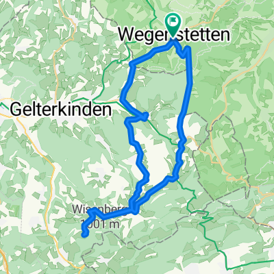
Rund um Schupfart
Cycling route in Wegenstetten, Canton of Aargau, Switzerland
- 21.5 km
- Distance
- 510 m
- Ascent
- 510 m
- Descent

Wegenstetten, Abzw. Schupfart nach Ochsengasse 2, Gelterkinden
Cycling route in Wegenstetten, Canton of Aargau, Switzerland
- 9.1 km
- Distance
- 65 m
- Ascent
- 107 m
- Descent

Schulstrasse 19, Hellikon nach Kellerackerstrasse 4–8, Stein AG
Cycling route in Wegenstetten, Canton of Aargau, Switzerland
- 14.4 km
- Distance
- 151 m
- Ascent
- 267 m
- Descent

Talmatt 1, Wegenstetten nach Pappelnweg 2, Rheinfelden
Cycling route in Wegenstetten, Canton of Aargau, Switzerland
- 15.2 km
- Distance
- 14 m
- Ascent
- 175 m
- Descent
Discover more routes
 Go 4 It
- Distance
- 33.5 km
- Ascent
- 798 m
- Descent
- 797 m
- Location
- Wegenstetten, Canton of Aargau, Switzerland
 Hauptstrasse 85, Wegenstetten nach Stadtweg 4, Rheinfelden
- Distance
- 14.6 km
- Ascent
- 12 m
- Descent
- 164 m
- Location
- Wegenstetten, Canton of Aargau, Switzerland
 Von Wegenstetten nach Bad Ramsach und zurück
- Distance
- 34.2 km
- Ascent
- 988 m
- Descent
- 910 m
- Location
- Wegenstetten, Canton of Aargau, Switzerland
 Wegenstetten - Deutsch Rheinfelden
- Distance
- 42.2 km
- Ascent
- 389 m
- Descent
- 389 m
- Location
- Wegenstetten, Canton of Aargau, Switzerland
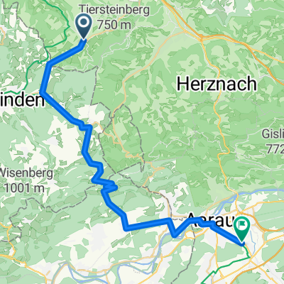
 Hauptstrasse 85, Wegenstetten nach Rosenrain 2, Frick
- Distance
- 8.8 km
- Ascent
- 169 m
- Descent
- 260 m
- Location
- Wegenstetten, Canton of Aargau, Switzerland
 Gründelenmatthof 360, Wegenstetten nach Marktplatz 9, Würzburg
- Distance
- 429.3 km
- Ascent
- 2,283 m
- Descent
- 2,609 m
- Location
- Wegenstetten, Canton of Aargau, Switzerland
 Wegenstetten - Triengen
- Distance
- 45.7 km
- Ascent
- 213 m
- Descent
- 138 m
- Location
- Wegenstetten, Canton of Aargau, Switzerland
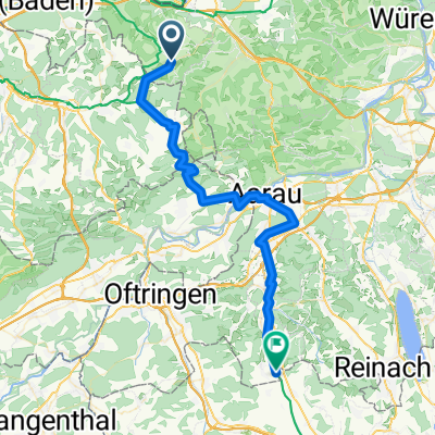
 Wegenstetten - Suhr AG
- Distance
- 28.4 km
- Ascent
- 160 m
- Descent
- 138 m
- Location
- Wegenstetten, Canton of Aargau, Switzerland