
Cycling in Villnachern
Discover a map of 117 cycling routes and bike trails near Villnachern, created by our community.
Region portrait
Get to know Villnachern
Find the right bike route for you through Villnachern, where we've got 117 cycle routes to explore. Most people get on their bikes to ride here in the months of June and July.
4,131 km
Tracked distance
117
Cycle routes
1,473
Population
Community
Most active users in Villnachern


From our community
The best bike routes in and around Villnachern

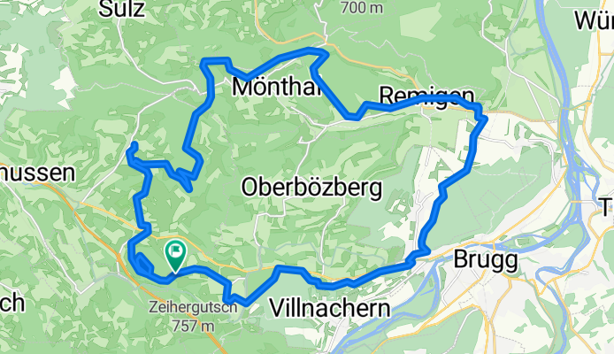
Bözberg-Sennhütte-Remigen
Cycling route in Villnachern, Canton of Aargau, Switzerland
- 19.3 km
- Distance
- 362 m
- Ascent
- 362 m
- Descent
Sonntag-Schlechtwetter Tour 10.5.20
Cycling route in Villnachern, Canton of Aargau, Switzerland
- 33 km
- Distance
- 638 m
- Ascent
- 638 m
- Descent

Lange Radrunde von Bözberg nach Zürich
Cycling route in Villnachern, Canton of Aargau, Switzerland
- 45.2 km
- Distance
- 193 m
- Ascent
- 321 m
- Descent

Teil 4
Cycling route in Villnachern, Canton of Aargau, Switzerland
- 35.5 km
- Distance
- 539 m
- Ascent
- 544 m
- Descent
Discover more routes
 Effingen nach Olten
- Distance
- 32.4 km
- Ascent
- 416 m
- Descent
- 457 m
- Location
- Villnachern, Canton of Aargau, Switzerland
 Linn - Buchs
- Distance
- 16 km
- Ascent
- 398 m
- Descent
- 594 m
- Location
- Villnachern, Canton of Aargau, Switzerland
 Arbeitsweg 1 Effingen-Olten
- Distance
- 29.3 km
- Ascent
- 394 m
- Descent
- 443 m
- Location
- Villnachern, Canton of Aargau, Switzerland
 Villnachern-Gansingen
- Distance
- 14.1 km
- Ascent
- 212 m
- Descent
- 218 m
- Location
- Villnachern, Canton of Aargau, Switzerland
 Birr - herznach - umliegende hügel - Birr
- Distance
- 35.9 km
- Ascent
- 750 m
- Descent
- 921 m
- Location
- Villnachern, Canton of Aargau, Switzerland
 Kanalstrasse, Villnachern nach Werkstrasse, Auenstein
- Distance
- 9.3 km
- Ascent
- 45 m
- Descent
- 38 m
- Location
- Villnachern, Canton of Aargau, Switzerland
 Bäumliackerweg 4–8, Villnachern do Bäumliackerweg 4–8, Villnachern
- Distance
- 0.1 km
- Ascent
- 0 m
- Descent
- 0 m
- Location
- Villnachern, Canton of Aargau, Switzerland
 Elfingen kiskör
- Distance
- 11.9 km
- Ascent
- 197 m
- Descent
- 195 m
- Location
- Villnachern, Canton of Aargau, Switzerland