
Cycling in Veltheim
Discover a map of 118 cycling routes and bike trails near Veltheim, created by our community.
Region portrait
Get to know Veltheim
Find the right bike route for you through Veltheim, where we've got 118 cycle routes to explore. Most people get on their bikes to ride here in the months of April and August.
9,809 km
Tracked distance
118
Cycle routes
1,374
Population
Community
Most active users in Veltheim


From our community
The best bike routes in and around Veltheim

Hochdorf - Herlisberg - Böhler
Cycling route in Veltheim, Canton of Aargau, Switzerland
Herlisberg esch am Schluss au de Ablöscher
- 89.4 km
- Distance
- 731 m
- Ascent
- 731 m
- Descent

Niesenberg mit Hallwilersee
Cycling route in Veltheim, Canton of Aargau, Switzerland
Holderbank - Boswil -Niesenberg - Mosen - Lenzburg - Holderbank
Durchschnittliche Steigung: 3%
Maximale Steigung: 8%
- 59.1 km
- Distance
- 463 m
- Ascent
- 463 m
- Descent

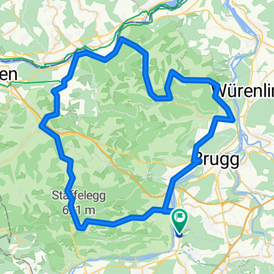
Hallwilersee - Saalhöhe - Benkerjoch - Staffelegg
Cycling route in Veltheim, Canton of Aargau, Switzerland
Hallwilersee - Saalhöhe - Benkerjoch - Staffelegg
Durchschn. Steigung: 6%
Max. Steigung: 9%
- 99 km
- Distance
- 1,262 m
- Ascent
- 1,255 m
- Descent

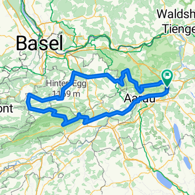
Buchenegg - Albispass - Ägerisee - Zugersee - Baldeggersee
Cycling route in Veltheim, Canton of Aargau, Switzerland
Max. Steigung: 9%
Durchschn. Steigung: 3%
- 179.3 km
- Distance
- 1,362 m
- Ascent
- 1,362 m
- Descent
Discover more routes
 Staffelegg - Benkerjoch - Saalhöhe - Kaistenberg - Bürersteig - Grünegg - Bözberg - Staffelegg
- Distance
- 132.3 km
- Ascent
- 1,913 m
- Descent
- 1,923 m
- Location
- Veltheim, Canton of Aargau, Switzerland
 Staffelegg - Kaisten - Laufenburg - Villigen
- Distance
- 68.8 km
- Ascent
- 885 m
- Descent
- 885 m
- Location
- Veltheim, Canton of Aargau, Switzerland
 Hochdorf-Sempach-Sursee-retour
- Distance
- 93.8 km
- Ascent
- 693 m
- Descent
- 693 m
- Location
- Veltheim, Canton of Aargau, Switzerland
 Weissenstein (Nordrampe)
- Distance
- 143 km
- Ascent
- 1,231 m
- Descent
- 1,229 m
- Location
- Veltheim, Canton of Aargau, Switzerland
 Passwang über Langenbruck mit Benkerjoch und Staffelegg
- Distance
- 152.6 km
- Ascent
- 1,835 m
- Descent
- 1,832 m
- Location
- Veltheim, Canton of Aargau, Switzerland
 Staffelegg - Benkerjoch - Saalhöhe - Bözberg - Geissberg - Staffelegg
- Distance
- 129.5 km
- Ascent
- 1,779 m
- Descent
- 1,779 m
- Location
- Veltheim, Canton of Aargau, Switzerland
 Zugersee
- Distance
- 118.7 km
- Ascent
- 410 m
- Descent
- 410 m
- Location
- Veltheim, Canton of Aargau, Switzerland
 Lindenberg mit Herlisberg
- Distance
- 86.1 km
- Ascent
- 901 m
- Descent
- 901 m
- Location
- Veltheim, Canton of Aargau, Switzerland