
Cycling in Urnäsch
Discover a map of 69 cycling routes and bike trails near Urnäsch, created by our community.
Region portrait
Get to know Urnäsch
Find the right bike route for you through Urnäsch, where we've got 69 cycle routes to explore. Most people get on their bikes to ride here in the months of June and July.
3,811 km
Tracked distance
69
Cycle routes
2,304
Population
Community
Most active users in Urnäsch


From our community
The best bike routes in and around Urnäsch

053_1220_Schwägalp_Hemberg_St.Peterszell
Cycling route in Urnäsch, Canton of Appenzell Ausserrhoden, Switzerland
- 53.4 km
- Distance
- 1,218 m
- Ascent
- 1,221 m
- Descent

078_1550_Urnäsch-Trogen-Altstädten
Cycling route in Urnäsch, Canton of Appenzell Ausserrhoden, Switzerland
- 77.8 km
- Distance
- 1,438 m
- Ascent
- 1,409 m
- Descent

144_1730_Urnäsch-Appenzell-Bregenz-Wittenbach
Cycling route in Urnäsch, Canton of Appenzell Ausserrhoden, Switzerland
- 143.8 km
- Distance
- 1,335 m
- Ascent
- 1,342 m
- Descent

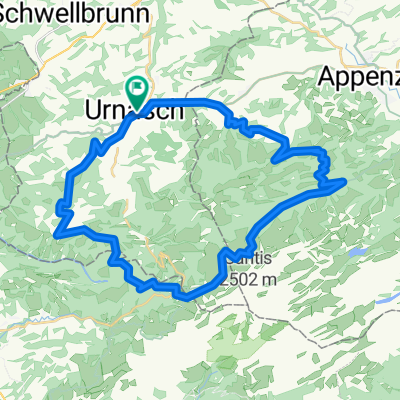
Rund um Kronberg
Cycling route in Urnäsch, Canton of Appenzell Ausserrhoden, Switzerland
- 41.3 km
- Distance
- 1,429 m
- Ascent
- 1,426 m
- Descent
Discover more routes
 Appenzellerstrasse 6, Urnäsch nach Kaustrasse 123, Appenzell
- Distance
- 52.8 km
- Ascent
- 2,412 m
- Descent
- 2,143 m
- Location
- Urnäsch, Canton of Appenzell Ausserrhoden, Switzerland
 Rund um Kronberg
- Distance
- 41.3 km
- Ascent
- 1,429 m
- Descent
- 1,426 m
- Location
- Urnäsch, Canton of Appenzell Ausserrhoden, Switzerland
 Schwägalptour
- Distance
- 66.1 km
- Ascent
- 1,320 m
- Descent
- 1,320 m
- Location
- Urnäsch, Canton of Appenzell Ausserrhoden, Switzerland
 Urnäsch,Appenzell, Ruppenpass, Eichberg, Oberriet, Buchs, Balzers, Luzisteig,, Maienfeld, Chur, Thusis
- Distance
- 124.5 km
- Ascent
- 1,462 m
- Descent
- 1,579 m
- Location
- Urnäsch, Canton of Appenzell Ausserrhoden, Switzerland
 E10V+12km-Variante Hemberg
- Distance
- 34.9 km
- Ascent
- 717 m
- Descent
- 799 m
- Location
- Urnäsch, Canton of Appenzell Ausserrhoden, Switzerland
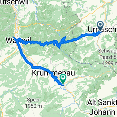
 Urnäsch - Weinfelden
- Distance
- 51.9 km
- Ascent
- 101 m
- Descent
- 504 m
- Location
- Urnäsch, Canton of Appenzell Ausserrhoden, Switzerland
 ürnasch-appenzell
- Distance
- 10.9 km
- Ascent
- 98 m
- Descent
- 149 m
- Location
- Urnäsch, Canton of Appenzell Ausserrhoden, Switzerland
 Zweiter Tag 1.Route
- Distance
- 92.5 km
- Ascent
- 1,338 m
- Descent
- 1,345 m
- Location
- Urnäsch, Canton of Appenzell Ausserrhoden, Switzerland