")
Cycling in Töss (Kreis 4)
Discover a map of 71 cycling routes and bike trails near Töss (Kreis 4), created by our community.
Region portrait
Get to know Töss (Kreis 4)
Find the right bike route for you through Töss (Kreis 4), where we've got 71 cycle routes to explore. Most people get on their bikes to ride here in the months of May and July.
4,968 km
Tracked distance
71
Cycle routes
8,672
Population
Community
Most active users in Töss (Kreis 4)

Handpicked routes
Discover Töss (Kreis 4) through these collections
Tour
Tour
From our community
The best bike routes in and around Töss (Kreis 4)

Lange Ausfahrt von Winterthur nach Nürensdorf
Cycling route in Töss (Kreis 4), Canton of Zurich, Switzerland
- 63.1 km
- Distance
- 376 m
- Ascent
- 303 m
- Descent

Falch Rund um Winterthur
Cycling route in Töss (Kreis 4), Canton of Zurich, Switzerland
- 31.9 km
- Distance
- 192 m
- Ascent
- 192 m
- Descent

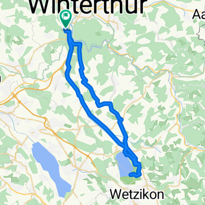
Töss runde
Cycling route in Töss (Kreis 4), Canton of Zurich, Switzerland
- 19.8 km
- Distance
- 125 m
- Ascent
- 129 m
- Descent

Arbeitsweg Jasmin hinweg
Cycling route in Töss (Kreis 4), Canton of Zurich, Switzerland
- 10.6 km
- Distance
- 75 m
- Ascent
- 101 m
- Descent
Discover more routes
 UHU Golfplatz-First-Wald-Töss
- Distance
- 23.8 km
- Ascent
- 341 m
- Descent
- 341 m
- Location
- Töss (Kreis 4), Canton of Zurich, Switzerland
 001 Dättnau - Egnach, SA 25.07.20
- Distance
- 71.4 km
- Ascent
- 317 m
- Descent
- 378 m
- Location
- Töss (Kreis 4), Canton of Zurich, Switzerland
 Restful route in Winterthur
- Distance
- 33.3 km
- Ascent
- 434 m
- Descent
- 434 m
- Location
- Töss (Kreis 4), Canton of Zurich, Switzerland
 Winterberg-Hulftegg-Winterberg
- Distance
- 81.4 km
- Ascent
- 823 m
- Descent
- 823 m
- Location
- Töss (Kreis 4), Canton of Zurich, Switzerland
 Dammwiesenstrasse 10, Winterthur nach In Wannen 17, Winterthur
- Distance
- 44.4 km
- Ascent
- 570 m
- Descent
- 568 m
- Location
- Töss (Kreis 4), Canton of Zurich, Switzerland
 Rossberg Waldtour
- Distance
- 8.7 km
- Ascent
- 219 m
- Descent
- 216 m
- Location
- Töss (Kreis 4), Canton of Zurich, Switzerland
 Winterthur to Freudenstadt
- Distance
- 148.8 km
- Ascent
- 1,305 m
- Descent
- 991 m
- Location
- Töss (Kreis 4), Canton of Zurich, Switzerland
 Winterthur - Schauenberg
- Distance
- 47.4 km
- Ascent
- 728 m
- Descent
- 728 m
- Location
- Töss (Kreis 4), Canton of Zurich, Switzerland