
Cycling in Plan-les-Ouates
Discover a map of 293 cycling routes and bike trails near Plan-les-Ouates, created by our community.
Region portrait
Get to know Plan-les-Ouates
Find the right bike route for you through Plan-les-Ouates, where we've got 293 cycle routes to explore. Most people get on their bikes to ride here in the months of May and August.
13,045 km
Tracked distance
293
Cycle routes
10,540
Population
Community
Most active users in Plan-les-Ouates


Handpicked routes
Discover Plan-les-Ouates through these collections
Tour
Tour
From our community
The best bike routes in and around Plan-les-Ouates

Tour du Canton GE - 25.09.2010
Cycling route in Plan-les-Ouates, Canton of Geneva, Switzerland
- 54.6 km
- Distance
- 459 m
- Ascent
- 459 m
- Descent

TALPO 1
Cycling route in Plan-les-Ouates, Canton of Geneva, Switzerland
- 71.2 km
- Distance
- 360 m
- Ascent
- 360 m
- Descent

Salève Pitons
Cycling route in Plan-les-Ouates, Canton of Geneva, Switzerland
- 46.5 km
- Distance
- 1,015 m
- Ascent
- 1,024 m
- Descent


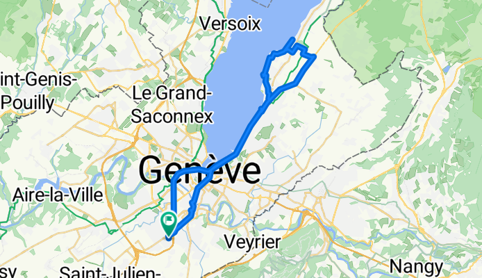
Chemin de la Milice, Plan-les-Ouates à Route du Camp, Plan-les-Ouates
Cycling route in Plan-les-Ouates, Canton of Geneva, Switzerland
- 34.5 km
- Distance
- 201 m
- Ascent
- 199 m
- Descent
Discover more routes
 Col De Saxel From PLO
- Distance
- 64 km
- Ascent
- 905 m
- Descent
- 905 m
- Location
- Plan-les-Ouates, Canton of Geneva, Switzerland
 Tours du Vuach
- Distance
- 74.8 km
- Ascent
- 727 m
- Descent
- 724 m
- Location
- Plan-les-Ouates, Canton of Geneva, Switzerland
 Variant On Tour Du Vuache (Bower)
- Distance
- 74.3 km
- Ascent
- 674 m
- Descent
- 673 m
- Location
- Plan-les-Ouates, Canton of Geneva, Switzerland
 Romontschia 1
- Distance
- 531 km
- Ascent
- 5,029 m
- Descent
- 5,349 m
- Location
- Plan-les-Ouates, Canton of Geneva, Switzerland
 De Route du Vélodrome 22, Plan-les-Ouates à Route du Vélodrome 22, Plan-les-Ouates
- Distance
- 101.8 km
- Ascent
- 553 m
- Descent
- 551 m
- Location
- Plan-les-Ouates, Canton of Geneva, Switzerland
 Col de la Faucille, Valserine, Fort Ecluse ,PLO
- Distance
- 107.8 km
- Ascent
- 1,302 m
- Descent
- 1,298 m
- Location
- Plan-les-Ouates, Canton of Geneva, Switzerland
 palettes-ups
- Distance
- 10.8 km
- Ascent
- 99 m
- Descent
- 70 m
- Location
- Plan-les-Ouates, Canton of Geneva, Switzerland
 De Route du Vélodrome 54, Plan-les-Ouates à Route du Vélodrome 26, Plan-les-Ouates
- Distance
- 94 km
- Ascent
- 621 m
- Descent
- 617 m
- Location
- Plan-les-Ouates, Canton of Geneva, Switzerland
Routes from Plan-les-Ouates
Cycling day trip from
Plan-les-Ouates to Cranves-Sales