
Cycling in Martigny-Ville
Discover a map of 777 cycling routes and bike trails near Martigny-Ville, created by our community.
Region portrait
Get to know Martigny-Ville
Find the right bike route for you through Martigny-Ville, where we've got 777 cycle routes to explore. Most people get on their bikes to ride here in the months of June and August.
112,525 km
Tracked distance
777
Cycle routes
14,768
Population
Community
Most active users in Martigny-Ville


Handpicked routes
Discover Martigny-Ville through these collections


From our community
The best bike routes in and around Martigny-Ville
![[Martigny_000] Col de la Croix de Cœur.](https://media.bikemap.net/routes/7803337/staticmaps/in_cdd017ee-75fd-46e2-a0ec-c59e19bcda56_694x400_bikemap-2021-3D-static.png)
[Martigny_000] Col de la Croix de Cœur.
Cycling route in Martigny-Ville, Valais, Switzerland
- 69.2 km
- Distance
- 1,694 m
- Ascent
- 1,695 m
- Descent

Alpencross 2007/1 - Martigny/CH bis Aosta/I
Cycling route in Martigny-Ville, Valais, Switzerland
- 89.2 km
- Distance
- 2,705 m
- Ascent
- 2,584 m
- Descent

Colonel
Cycling route in Martigny-Ville, Valais, Switzerland
- 214.5 km
- Distance
- 3,599 m
- Ascent
- 3,601 m
- Descent

Belle montée, peu de voitures
Cycling route in Martigny-Ville, Valais, Switzerland
- 20.4 km
- Distance
- 975 m
- Ascent
- 38 m
- Descent
Discover more routes
 Etape 4 : Martigny - Station de Verbier (Tour de Suisse, Aramis) 40 km
- Distance
- 40.5 km
- Ascent
- 2,293 m
- Descent
- 653 m
- Location
- Martigny-Ville, Valais, Switzerland
 VR04 Martigny-St Gingolph.kml - VR04 Martigny-St Gingolph.kml_VR04 Martigny-St Gingolph
- Distance
- 60.4 km
- Ascent
- 408 m
- Descent
- 484 m
- Location
- Martigny-Ville, Valais, Switzerland
 1. Etappe: Martigny - Rund um den Mont Blanc nach Les Saisies
- Distance
- 100 km
- Ascent
- 2,702 m
- Descent
- 1,515 m
- Location
- Martigny-Ville, Valais, Switzerland
 Martigny - C de la Forclaz - Finhaut - Chamonix
- Distance
- 56 km
- Ascent
- 1,858 m
- Descent
- 1,287 m
- Location
- Martigny-Ville, Valais, Switzerland
 Forclaz backroad - Champex Lac - Col des Planches / Col du Lein
- Distance
- 102 km
- Ascent
- 3,119 m
- Descent
- 3,118 m
- Location
- Martigny-Ville, Valais, Switzerland
 Jumelage 2015, étape 1
- Distance
- 127.6 km
- Ascent
- 1,987 m
- Descent
- 2,149 m
- Location
- Martigny-Ville, Valais, Switzerland
 Martigny - Col du Sanetsch
- Distance
- 55.5 km
- Ascent
- 1,768 m
- Descent
- 193 m
- Location
- Martigny-Ville, Valais, Switzerland
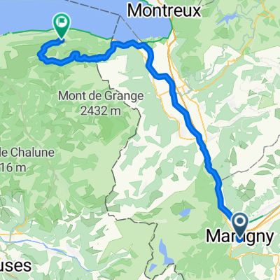 Martigny-Thollon
- Distance
- 69.9 km
- Ascent
- 1,891 m
- Descent
- 1,444 m
- Location
- Martigny-Ville, Valais, Switzerland