
Cycling in Cugy
Discover a map of 64 cycling routes and bike trails near Cugy, created by our community.
Region portrait
Get to know Cugy
Find the right bike route for you through Cugy, where we've got 64 cycle routes to explore. Most people get on their bikes to ride here in the months of May and June.
2,905 km
Tracked distance
64
Cycle routes
1,523
Population
Community
Most active users in Cugy


From our community
The best bike routes in and around Cugy
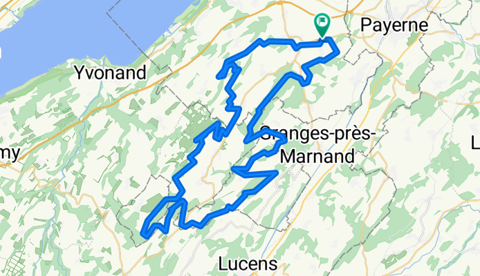
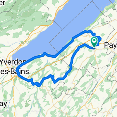
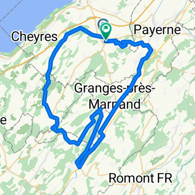
Vallons broyards
Cycling route in Cugy, Canton of Fribourg, Switzerland
- 54.2 km
- Distance
- 1,336 m
- Ascent
- 1,337 m
- Descent
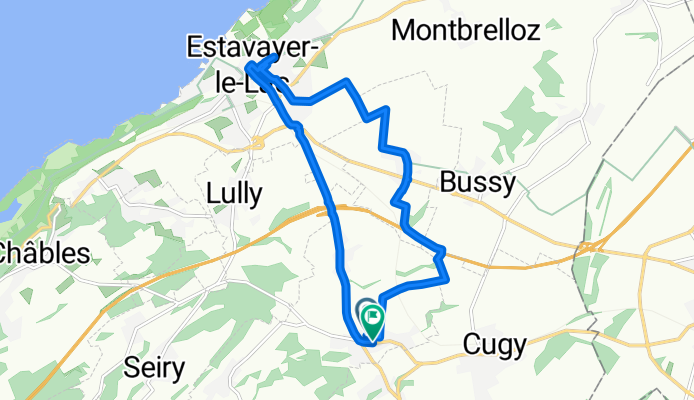
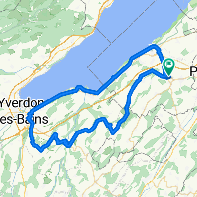
Montet estavazer
Cycling route in Cugy, Canton of Fribourg, Switzerland
- 12.1 km
- Distance
- 64 m
- Ascent
- 63 m
- Descent
Les Saugettes, Montet (Broye) à Les Saugettes, Montet (Broye)
Cycling route in Cugy, Canton of Fribourg, Switzerland
- 37 km
- Distance
- 254 m
- Ascent
- 253 m
- Descent
De Sentier Sous-Bosset 2, Valbroye à Route d'Onnens 1, Neyruz
Cycling route in Cugy, Canton of Fribourg, Switzerland
- 18.2 km
- Distance
- 373 m
- Ascent
- 155 m
- Descent
Discover more routes
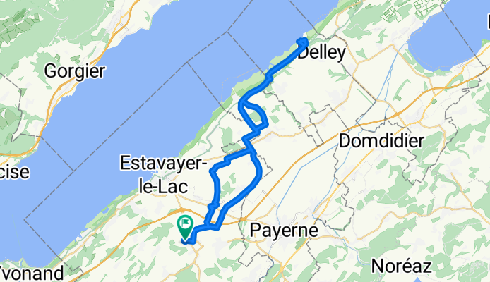
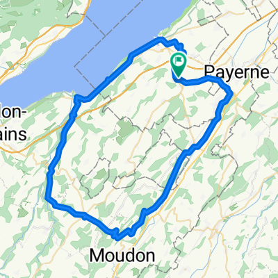
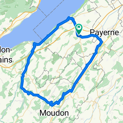
 Montet-Yverdon-Montet
- Distance
- 56.8 km
- Ascent
- 511 m
- Descent
- 513 m
- Location
- Cugy, Canton of Fribourg, Switzerland
 Montet-Lucens-Yvonand-Estavayer-Montet
- Distance
- 62.9 km
- Ascent
- 483 m
- Descent
- 483 m
- Location
- Cugy, Canton of Fribourg, Switzerland
 Montet-Murist-Ursins-Yverdon- Montet
- Distance
- 56.5 km
- Ascent
- 429 m
- Descent
- 429 m
- Location
- Cugy, Canton of Fribourg, Switzerland
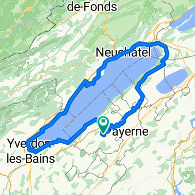 Giro lago di Neuchatel
- Distance
- 111.5 km
- Ascent
- 287 m
- Descent
- 286 m
- Location
- Cugy, Canton of Fribourg, Switzerland
 Montet-Murist-Ursins-Yverdon- Montet
- Distance
- 49.3 km
- Ascent
- 388 m
- Descent
- 382 m
- Location
- Cugy, Canton of Fribourg, Switzerland
 Montet-Lucens-Yvonant-Montet def
- Distance
- 61.3 km
- Ascent
- 501 m
- Descent
- 501 m
- Location
- Cugy, Canton of Fribourg, Switzerland
 Recovered Route
- Distance
- 54 km
- Ascent
- 696 m
- Descent
- 646 m
- Location
- Cugy, Canton of Fribourg, Switzerland
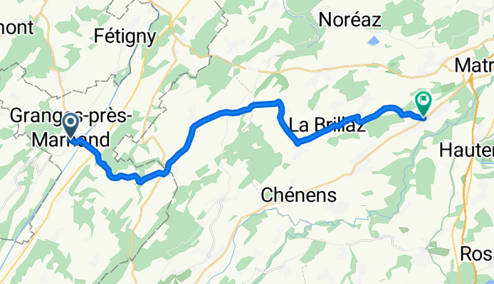
 De En Brit 4–8, Granges-Marnand à Route de Corcelles 2–28, Corcelles-Payerne
- Distance
- 11.3 km
- Ascent
- 103 m
- Descent
- 73 m
- Location
- Cugy, Canton of Fribourg, Switzerland