
Cycling in Caux
Discover a map of 70 cycling routes and bike trails near Caux, created by our community.
Region portrait
Get to know Caux
Find the right bike route for you through Caux, where we've got 70 cycle routes to explore. Most people get on their bikes to ride here in the month of July.
4,538 km
Tracked distance
70
Cycle routes
2,000
Population
Community
Most active users in Caux


From our community
The best bike routes in and around Caux

ColJaman-Les Paccots
Cycling route in Caux, Canton of Vaud, Switzerland
- 18.7 km
- Distance
- 464 m
- Ascent
- 774 m
- Descent

5. Etappe: Col de Jaman - Les Gets
Cycling route in Caux, Canton of Vaud, Switzerland
- 98 km
- Distance
- 1,379 m
- Ascent
- 1,309 m
- Descent

CLemay-Alpes-Jour3-Montreux-Thonon
Cycling route in Caux, Canton of Vaud, Switzerland
Jour 3 du Voyage Genève-Nice, De Glion (Montreux) à Thonon-les-Bains.
- 87.3 km
- Distance
- 1,076 m
- Ascent
- 1,338 m
- Descent

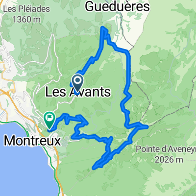
Léman - Hongrin 2
Cycling route in Caux, Canton of Vaud, Switzerland
Un magnifique parcours d'arrière saison.
Montée aux Avants en passant par Sonloup.
A 11h07, train des Avants aux Allières (10 min, 3 arrêts).
Montée vers le lac de l'Hongrin jusqu'à la Lécherette, retour par la route militaire (48 ponts).
Descente finale sur
- 46.2 km
- Distance
- 708 m
- Ascent
- 1,304 m
- Descent
Discover more routes
 Leman_Etappe_4
- Distance
- 10 km
- Ascent
- 62 m
- Descent
- 652 m
- Location
- Caux, Canton of Vaud, Switzerland
 First ride, 06-07.09.2013
- Distance
- 34.2 km
- Ascent
- 1,039 m
- Descent
- 1,372 m
- Location
- Caux, Canton of Vaud, Switzerland
 Route des Narcisses 42, Les Avants à Route des Narcisses 42, Les Avants
- Distance
- 10.9 km
- Ascent
- 424 m
- Descent
- 430 m
- Location
- Caux, Canton of Vaud, Switzerland
 tour du vanil noir
- Distance
- 85.5 km
- Ascent
- 1,103 m
- Descent
- 1,325 m
- Location
- Caux, Canton of Vaud, Switzerland
 Recorded via Apple Watch - 05.09.21 17:01
- Distance
- 8.2 km
- Ascent
- 351 m
- Descent
- 355 m
- Location
- Caux, Canton of Vaud, Switzerland
 Montreux-LePaquier
- Distance
- 45.6 km
- Ascent
- 1,217 m
- Descent
- 1,466 m
- Location
- Caux, Canton of Vaud, Switzerland
 Bourg-en-Bresse - Caux-Palace
- Distance
- 198 km
- Ascent
- 1,530 m
- Descent
- 2,339 m
- Location
- Caux, Canton of Vaud, Switzerland
 Dent de Jaman - Rochers de Nayes
- Distance
- 28 km
- Ascent
- 1,569 m
- Descent
- 1,963 m
- Location
- Caux, Canton of Vaud, Switzerland