
Cycling in Attalens
Discover a map of 32 cycling routes and bike trails near Attalens, created by our community.
Region portrait
Get to know Attalens
Find the right bike route for you through Attalens, where we've got 32 cycle routes to explore. Most people get on their bikes to ride here in the month of May.
3,587 km
Tracked distance
32
Cycle routes
2,380
Population
Community
Most active users in Attalens

From our community
The best bike routes in and around Attalens
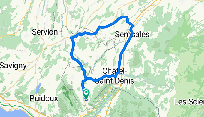
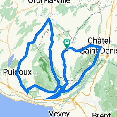
Attalens / Oron / Semsales / Chàtel-Saint-Denis / Attalens
Cycling route in Attalens, Canton of Fribourg, Switzerland
Gute Feierabend-Runde mit z.T. längeren Anstiegen.
- 37.7 km
- Distance
- 427 m
- Ascent
- 430 m
- Descent
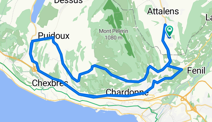
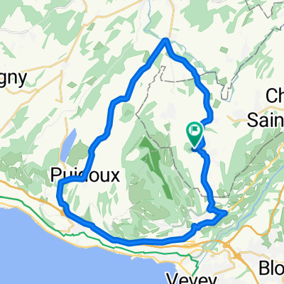
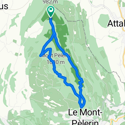
Mont-Pélerin / Genfer See
Cycling route in Attalens, Canton of Fribourg, Switzerland
Sehr schöne Strecke z.T. über dem Genfer See und zwischen Weinbergen. Teilweise recht steile Anstiege.
- 28 km
- Distance
- 460 m
- Ascent
- 459 m
- Descent
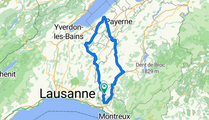
Circuit Estavayer-Le-Lac et la Glâne
Cycling route in Attalens, Canton of Fribourg, Switzerland
Circuit pour vélo de route entre Glâne et Broye
- 105.2 km
- Distance
- 980 m
- Ascent
- 980 m
- Descent
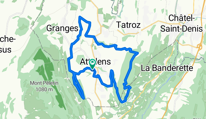
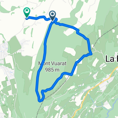
Parcours n°11 - Les Châteaux
Cycling route in Attalens, Canton of Fribourg, Switzerland
Parcours de difficulté moyenne reliant deux collines: Le Mont- Pèlerin et le Mont Vuarat. Entre les deux se blottit Attalens où vous ne manquerez pas d‘admirez son château-fort du XIIIe siècle, lieu de départ de la rando. A Bossonnens également, vous passerez devant les ruines en restauration de l‘ancien château du village.
- 17.8 km
- Distance
- 401 m
- Ascent
- 402 m
- Descent
Discover more routes
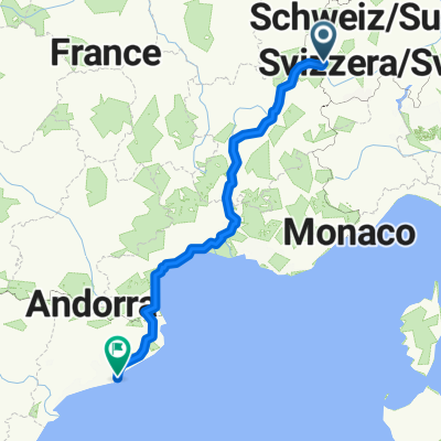 Reise nach Barcelona
- Distance
- 1,031.8 km
- Ascent
- 3,767 m
- Descent
- 4,538 m
- Location
- Attalens, Canton of Fribourg, Switzerland
 Snail-Like Dimanche Course In Attalens
- Distance
- 27.5 km
- Ascent
- 357 m
- Descent
- 355 m
- Location
- Attalens, Canton of Fribourg, Switzerland
 Itinéraire modéré en Blonay
- Distance
- 1.1 km
- Ascent
- 22 m
- Descent
- 0 m
- Location
- Attalens, Canton of Fribourg, Switzerland
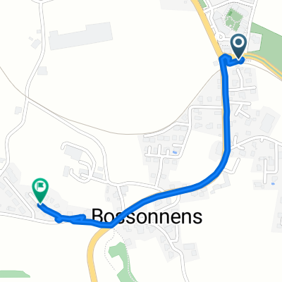
 Route en Chemins 2, Bossonnens à Route en Chemins 2, Bossonnens
- Distance
- 43.9 km
- Ascent
- 821 m
- Descent
- 822 m
- Location
- Attalens, Canton of Fribourg, Switzerland
 pédestre : Mont-Pèlerin De Chemin du Montcheseaux 7, Puidoux à Chemin du Montcheseaux 7, Puidoux
- Distance
- 8.1 km
- Ascent
- 264 m
- Descent
- 266 m
- Location
- Attalens, Canton of Fribourg, Switzerland
 Voie comme un escargot dans Le Mont-Pèlerin
- Distance
- 3.5 km
- Ascent
- 100 m
- Descent
- 28 m
- Location
- Attalens, Canton of Fribourg, Switzerland
 full vuarat circuit (without the part till we get to the Forrest since I forgot to record)
- Distance
- 5.6 km
- Ascent
- 204 m
- Descent
- 230 m
- Location
- Attalens, Canton of Fribourg, Switzerland
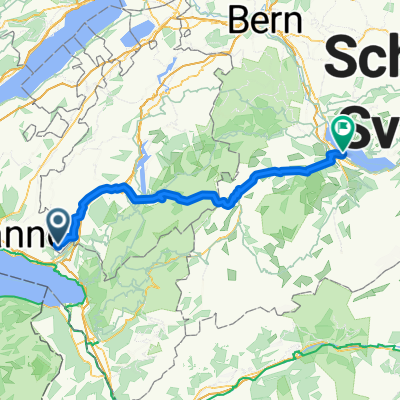 De Chemin de la Greppa 12, Attalens à Schachenstrasse 3 4, Spiez
- Distance
- 97.3 km
- Ascent
- 1,717 m
- Descent
- 1,858 m
- Location
- Attalens, Canton of Fribourg, Switzerland