
Cycling in Vils
Discover a map of 41 cycling routes and bike trails near Vils, created by our community.
Region portrait
Get to know Vils
Find the right bike route for you through Vils, where we've got 41 cycle routes to explore. Most people get on their bikes to ride here in the month of July.
1,505 km
Tracked distance
41
Cycle routes
Community
Most active users in Vils


From our community
The best bike routes in and around Vils


Discover more routes
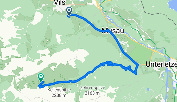
 Ostler Hütte
- Distance
- 10.7 km
- Ascent
- 278 m
- Descent
- 969 m
- Location
- Vils, Tyrol, Austria
 Hohenschwangau Hopfensee Burgenrunde
- Distance
- 44.3 km
- Ascent
- 318 m
- Descent
- 297 m
- Location
- Vils, Tyrol, Austria
 Stegen-Heiterwanger See
- Distance
- 20 km
- Ascent
- 305 m
- Descent
- 143 m
- Location
- Vils, Tyrol, Austria
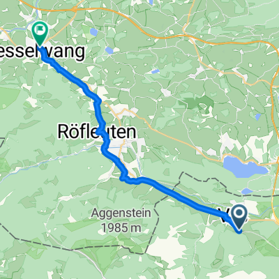
 PF -mahraton
- Distance
- 23.6 km
- Ascent
- 1,011 m
- Descent
- 689 m
- Location
- Vils, Tyrol, Austria
 Bernbeuern route
- Distance
- 57.1 km
- Ascent
- 632 m
- Descent
- 632 m
- Location
- Vils, Tyrol, Austria
 Weißensee-Falkenstein
- Distance
- 17 km
- Ascent
- 557 m
- Descent
- 512 m
- Location
- Vils, Tyrol, Austria
 Ettape3
- Distance
- 111.2 km
- Ascent
- 1,567 m
- Descent
- 1,473 m
- Location
- Vils, Tyrol, Austria
 47.543, 10.637 nach 47.625, 10.503
- Distance
- 16.3 km
- Ascent
- 218 m
- Descent
- 191 m
- Location
- Vils, Tyrol, Austria