
Cycling in Tulbing
Discover a map of 104 cycling routes and bike trails near Tulbing, created by our community.
Region portrait
Get to know Tulbing
Find the right bike route for you through Tulbing, where we've got 104 cycle routes to explore. Most people get on their bikes to ride here in the months of June and August.
2,626 km
Tracked distance
104
Cycle routes
Community
Most active users in Tulbing


Handpicked routes
Discover Tulbing through these collections

Tour
From our community
The best bike routes in and around Tulbing

Trainingsrunde 21.04.2014
Cycling route in Tulbing, Lower Austria, Austria
- 25.6 km
- Distance
- 52 m
- Ascent
- 52 m
- Descent

Wilfersdorf - Hollabrunn - Laa/Thaya
Cycling route in Tulbing, Lower Austria, Austria
- 85.1 km
- Distance
- 520 m
- Ascent
- 561 m
- Descent

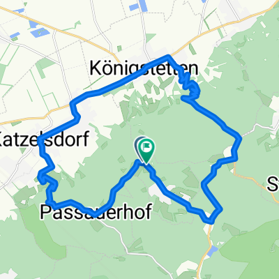
Passauer Hof und Verloren am Tulbinger Kogel
Cycling route in Tulbing, Lower Austria, Austria
- 13.6 km
- Distance
- 405 m
- Ascent
- 405 m
- Descent

Samstag_06_05_23
Cycling route in Tulbing, Lower Austria, Austria
- 76.1 km
- Distance
- 1,088 m
- Ascent
- 1,134 m
- Descent
Discover more routes
 T8 Freundorf Runde
- Distance
- 19.3 km
- Ascent
- 75 m
- Descent
- 75 m
- Location
- Tulbing, Lower Austria, Austria
 Donauland bis am Wagram
- Distance
- 67.5 km
- Ascent
- 209 m
- Descent
- 90 m
- Location
- Tulbing, Lower Austria, Austria
 Etappe16
- Distance
- 26 km
- Ascent
- 215 m
- Descent
- 325 m
- Location
- Tulbing, Lower Austria, Austria
 Wolfpassing1
- Distance
- 15.1 km
- Ascent
- 38 m
- Descent
- 266 m
- Location
- Tulbing, Lower Austria, Austria
 Tulbing-Kogl-Hintersdorf- Steinriegl-Weidlingbach- Mauerbach-Wilfersdorf-Tulbing
- Distance
- 31 km
- Ascent
- 472 m
- Descent
- 448 m
- Location
- Tulbing, Lower Austria, Austria
 Heimrunde
- Distance
- 16.8 km
- Ascent
- 555 m
- Descent
- 532 m
- Location
- Tulbing, Lower Austria, Austria
 MTB durch den nahen Wienerwald und an der Donau zurück
- Distance
- 67.2 km
- Ascent
- 771 m
- Descent
- 771 m
- Location
- Tulbing, Lower Austria, Austria
 Tulbinger-Kogel-Runde
- Distance
- 20.8 km
- Ascent
- 394 m
- Descent
- 392 m
- Location
- Tulbing, Lower Austria, Austria