
Cycling in Tattendorf
Discover a map of 83 cycling routes and bike trails near Tattendorf, created by our community.
Region portrait
Get to know Tattendorf
Find the right bike route for you through Tattendorf, where we've got 83 cycle routes to explore. Most people get on their bikes to ride here in the months of June and August.
2,341 km
Tracked distance
83
Cycle routes
Community
Most active users in Tattendorf


From our community
The best bike routes in and around Tattendorf


Testtitel :P sdflfsdjlkdsf alsdu skjfjsdf fj sdjfsdfjksdf osidjf osdjf okj osidflksj dofi sdfj oifj oiadsjfo aisjdoifj aosijf ioasjd foijasoif isajdfo iajsdfo i
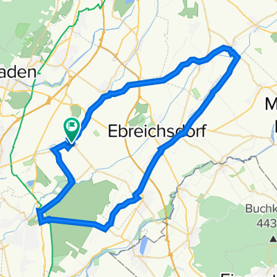
Cycling route in Tattendorf, Lower Austria, Austria
- 34.4 km
- Distance
- 100 m
- Ascent
- 74 m
- Descent


Discover more routes
 RR_55km
- Distance
- 55.4 km
- Ascent
- 88 m
- Descent
- 88 m
- Location
- Tattendorf, Lower Austria, Austria
 Sollenauerstraße 1, Blumau nach Unnamed Road
- Distance
- 6.8 km
- Ascent
- 5 m
- Descent
- 25 m
- Location
- Tattendorf, Lower Austria, Austria
 Helenental Landegg 74
- Distance
- 59 km
- Ascent
- 324 m
- Descent
- 369 m
- Location
- Tattendorf, Lower Austria, Austria
 Ingenieur Julius Raab Straße 1, Tattendorf nach Johann-Böhm-Straße 13, Kottingbrunn
- Distance
- 10.6 km
- Ascent
- 46 m
- Descent
- 14 m
- Location
- Tattendorf, Lower Austria, Austria
 Ingenieur Julius Raab Straße 1, Tattendorf nach Johann-Böhm-Straße 13, Kottingbrunn
- Distance
- 11.4 km
- Ascent
- 51 m
- Descent
- 66 m
- Location
- Tattendorf, Lower Austria, Austria
 Weinroute
- Distance
- 45.2 km
- Ascent
- 124 m
- Descent
- 116 m
- Location
- Tattendorf, Lower Austria, Austria
 rust2
rust2- Distance
- 40.8 km
- Ascent
- 307 m
- Descent
- 415 m
- Location
- Tattendorf, Lower Austria, Austria
 Pottendorfer Straße 4, Tattendorf nach Eisenstädter Straße 10, Wimpassing an der Leitha
- Distance
- 12.7 km
- Ascent
- 8 m
- Descent
- 27 m
- Location
- Tattendorf, Lower Austria, Austria