
Cycling in Scharnstein
Discover a map of 226 cycling routes and bike trails near Scharnstein, created by our community.
Region portrait
Get to know Scharnstein
Find the right bike route for you through Scharnstein, where we've got 226 cycle routes to explore. Most people get on their bikes to ride here in the months of July and August.
7,805 km
Tracked distance
226
Cycle routes
4,631
Population
Community
Most active users in Scharnstein


From our community
The best bike routes in and around Scharnstein

von Scharnstein ins Almtal
Cycling route in Scharnstein, Upper Austria, Austria
- 58.5 km
- Distance
- 347 m
- Ascent
- 353 m
- Descent


Einfache Fahrt in Vorchdorf
Cycling route in Scharnstein, Upper Austria, Austria
- 18.5 km
- Distance
- 138 m
- Ascent
- 194 m
- Descent

2025_05_27_Steinbach-Laudachsee
Cycling route in Scharnstein, Upper Austria, Austria
- 49.2 km
- Distance
- 1,293 m
- Ascent
- 1,294 m
- Descent

Discover more routes
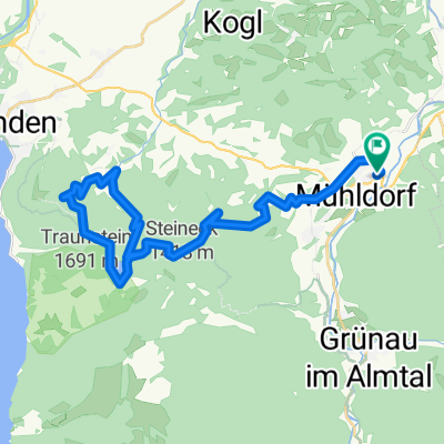
 Mühldorf nach Grünau im Altal
- Distance
- 20.7 km
- Ascent
- 266 m
- Descent
- 211 m
- Location
- Scharnstein, Upper Austria, Austria
 OBK Schobermühle (Hendl) Scharnstein
- Distance
- 4.2 km
- Ascent
- 93 m
- Descent
- 25 m
- Location
- Scharnstein, Upper Austria, Austria
 Rundfahrt über Feichtenberg
- Distance
- 29 km
- Ascent
- 396 m
- Descent
- 393 m
- Location
- Scharnstein, Upper Austria, Austria
 2023_06_26_Steineck
- Distance
- 42.9 km
- Ascent
- 1,219 m
- Descent
- 1,220 m
- Location
- Scharnstein, Upper Austria, Austria
 laudachsee
- Distance
- 38.6 km
- Ascent
- 1,543 m
- Descent
- 1,544 m
- Location
- Scharnstein, Upper Austria, Austria
 Zum Almsee
- Distance
- 57.5 km
- Ascent
- 242 m
- Descent
- 242 m
- Location
- Scharnstein, Upper Austria, Austria
 Viechtwang-Grünau_2
- Distance
- 18.3 km
- Ascent
- 149 m
- Descent
- 146 m
- Location
- Scharnstein, Upper Austria, Austria
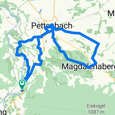 Pettenbach
- Distance
- 21.4 km
- Ascent
- 281 m
- Descent
- 281 m
- Location
- Scharnstein, Upper Austria, Austria