
Cycling in Raabs an der Thaya
Discover a map of 174 cycling routes and bike trails near Raabs an der Thaya, created by our community.
Region portrait
Get to know Raabs an der Thaya
Find the right bike route for you through Raabs an der Thaya, where we've got 174 cycle routes to explore. Most people get on their bikes to ride here in the months of July and August.
9,316 km
Tracked distance
174
Cycle routes
Community
Most active users in Raabs an der Thaya


From our community
The best bike routes in and around Raabs an der Thaya


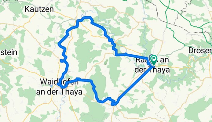
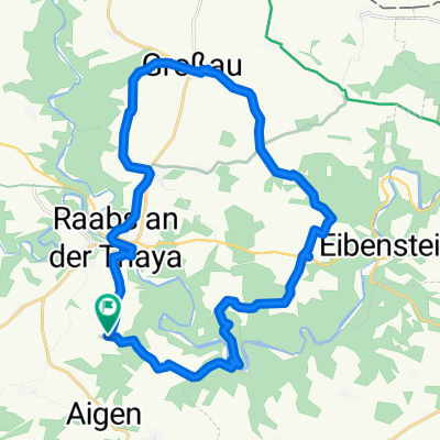
Hauptstraße nach Hauptstraße
Cycling route in Raabs an der Thaya, Lower Austria, Austria
- 63.9 km
- Distance
- 885 m
- Ascent
- 983 m
- Descent
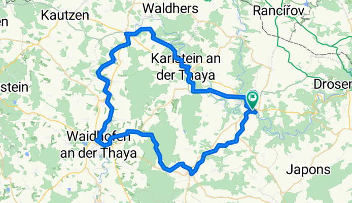
thayarunde
Cycling route in Raabs an der Thaya, Lower Austria, Austria
- 60.5 km
- Distance
- 789 m
- Ascent
- 794 m
- Descent
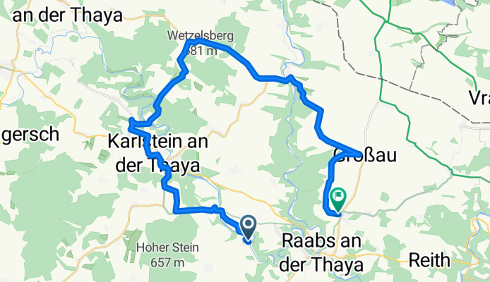
Liebnitz, Raabs an der Thaya nach Modsiedl, Raabs an der Thaya
Cycling route in Raabs an der Thaya, Lower Austria, Austria
- 28.8 km
- Distance
- 463 m
- Ascent
- 397 m
- Descent

Thaya Runde
Cycling route in Raabs an der Thaya, Lower Austria, Austria
- 88.8 km
- Distance
- 409 m
- Ascent
- 410 m
- Descent
Discover more routes
 Thayarunde Alternative 1 zu Entwurf 4
- Distance
- 60 km
- Ascent
- 546 m
- Descent
- 371 m
- Location
- Raabs an der Thaya, Lower Austria, Austria
 Thayarunde Entwurf 4
- Distance
- 72.6 km
- Ascent
- 563 m
- Descent
- 388 m
- Location
- Raabs an der Thaya, Lower Austria, Austria
 Hsgz Runde
- Distance
- 54.8 km
- Ascent
- 398 m
- Descent
- 331 m
- Location
- Raabs an der Thaya, Lower Austria, Austria
 Modsiedl Drosendorf
- Distance
- 11.1 km
- Ascent
- 108 m
- Descent
- 224 m
- Location
- Raabs an der Thaya, Lower Austria, Austria
 Lindau, Raabs an der Thaya nach Lindau, Raabs an der Thaya
- Distance
- 25.2 km
- Ascent
- 483 m
- Descent
- 483 m
- Location
- Raabs an der Thaya, Lower Austria, Austria
 31.07.10 - Einrollrunde an der Thaya
- Distance
- 27.1 km
- Ascent
- 397 m
- Descent
- 395 m
- Location
- Raabs an der Thaya, Lower Austria, Austria
 Tschechische Runde - Bitov - Vranov
- Distance
- 90.3 km
- Ascent
- 751 m
- Descent
- 751 m
- Location
- Raabs an der Thaya, Lower Austria, Austria
 Burgenrundfahrt im Nördlichen Waldviertel
- Distance
- 79.6 km
- Ascent
- 687 m
- Descent
- 687 m
- Location
- Raabs an der Thaya, Lower Austria, Austria